




Photographer Benjamin Grant has set off on a mission to change the way we see our planet with his stunning photo project - Daily Overview.
Every single day, Grant shares one satellite photo from Digital Globes to change the way we see our planet. "With a focal length 16 times longer than a standard DSLR camera, the cameras are so powerful that you can take a picture of a beach ball on the Golden Gate Bridge in full resolution…from Los Angeles," Grant told Bored Panda. "I try to present the images with no bias and let people decide what these altered landscapes mean, based on the facts and the visual evidence in the frame. I believe that this perspective is a means to start a conversation about the condition of our planet and how we can better protect it."
"I create the images by stitching together numerous high-resolution satellite photographs. I partnered with a satellite company called DigitalGlobe and accordingly have access to their full archive of imagery. Once I have put together a composite image, I then treat it like a photograph to make it as crisp and easy to understand as possible to accentuate certain patterns, colors, or places." The results are so amazing, Grant has even put together a book of over 200 high-resolution satellite photographs. It's titled "Overview: A New Perspective of Earth", and can be purchased through Amazon.
This post may include affiliate links.
#81 Residential Development, Killeen, Texas, USA
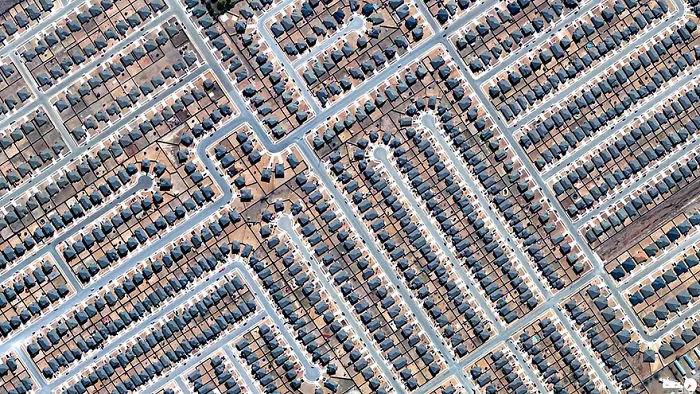
31.079844, -97.80145. In 2013, there were 923,400 home construction projects in the United States.
6points
#82 L'enfant Plan, Washington, D.C, USA
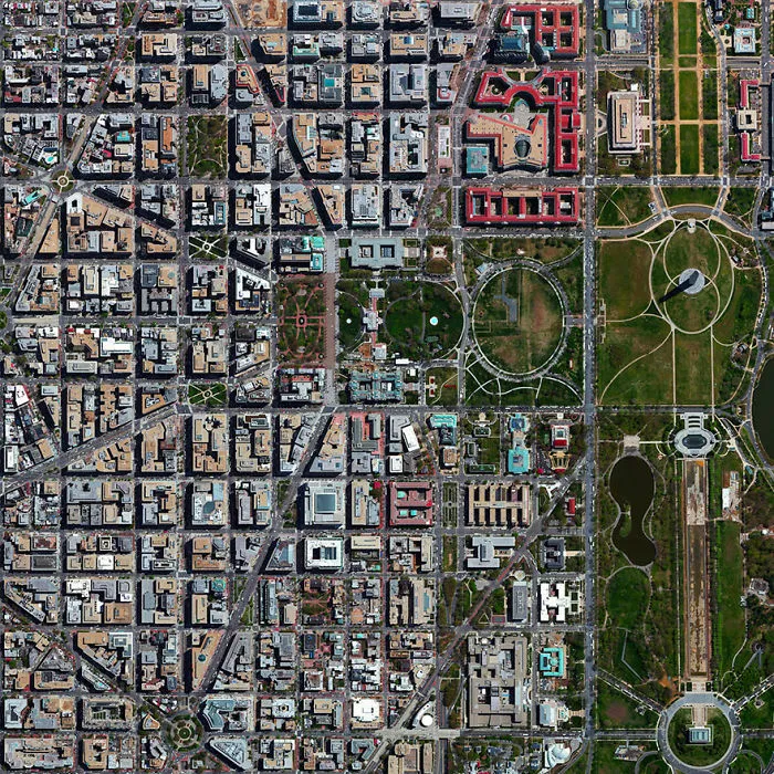
38°53′26″N 77°1′13″W. The city's L'Enfant Plan was developed in 1791 by Major Pierre Charles L'Enfant for George Washington, the first President of the United States. L’Enfant designed a compass-aligned grid for the city’s streets, with intersecting diagonal avenues that were later named after the states of the union. The diagonal avenues also intersect with the north-south and east-west streets at circles and rectangular plazas in order to create more open, green spaces. Lastly, L'Enfant laid out a 400 foot-wide (122 meter) garden-lined “grand avenue” - what is now know as the National Mall – that connects the US Capitol Building, the Washington Monument, and the Lincoln Memorial (the latter two are visible at right in this Overview).
5points
#83 London, England, UK
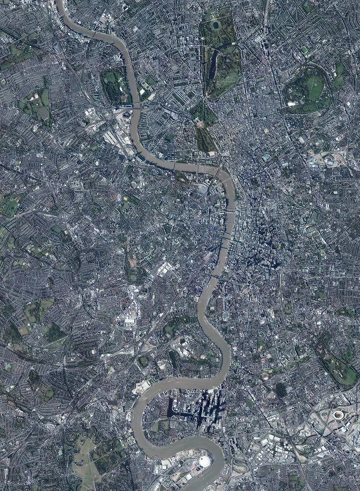
51°30′26″N 0°7′39″W. London is the capital and most populous city in the United Kingdom.
5points
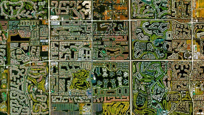
#85 Our Lady Of Almudena Cemetery, Madrid, Spain
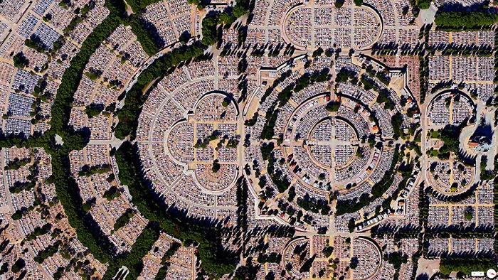
40°25′10″N 3°38′26″W. Our Lady of Almudena Cemetery in Madrid, Spain is one of the largest cemeteries in the world. The number of gravesites – estimated at five million – is greater than the population of Madrid itself.
5points
#86 Capital Hill, Canberra, Australia
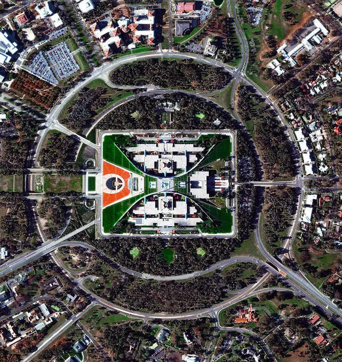
35°18′29″S 149°07′28″E. The construction of Parliament House in Canberra, Australia involved the removal of the top half of Capital Hill (the mound on which the structure was built). After the project was completed, much of the displaced earth was replaced on top of the building where a lush, green lawn now grows. While much of Canberra was designed by by Walter Burley Griffin in 1913, this specific complex opened in 1988, is designed to look like two boomerangs, and contains approximately 4,400 rooms.
4points
#87 L'eixample, Valencia, Spain
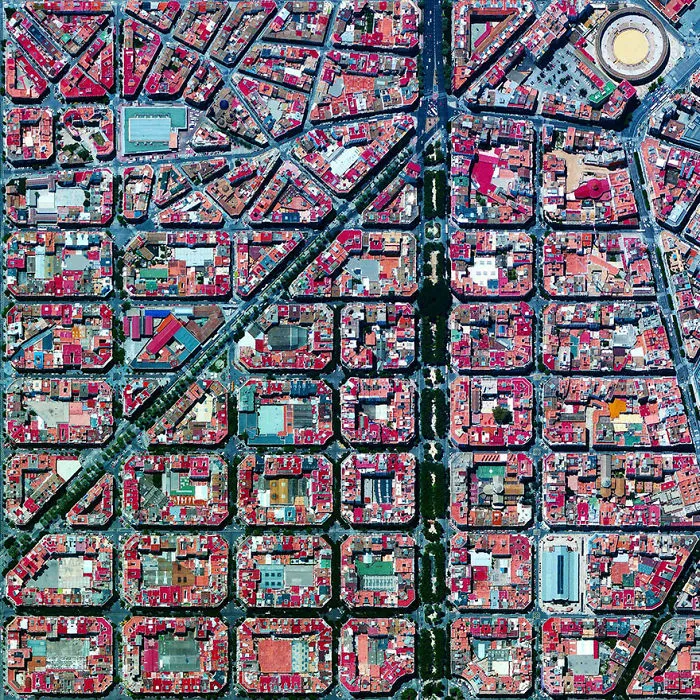
39°27′53″N 0°22′12″W. The urban plan of the L’Eixample district in Valencia, Spain is characterized by long straight streets, a strict grid pattern crossed by wide avenues, and apartments with communal courtyards. A similar layout was used for the district of the same name in Barcelona. The circular structure in the upper right is the Plaza de Toros de Valencia - the city’s largest bullfighting arena.
4points
#88 Bosphorus Bridge, Istanbul, Turkey

41°02′43″N 29°02′04″E. The Bosphorus Bridge is one of two suspension bridges that connects Europe and Asia across the Bosphorus Strait in Istanbul, Turkey.
4points
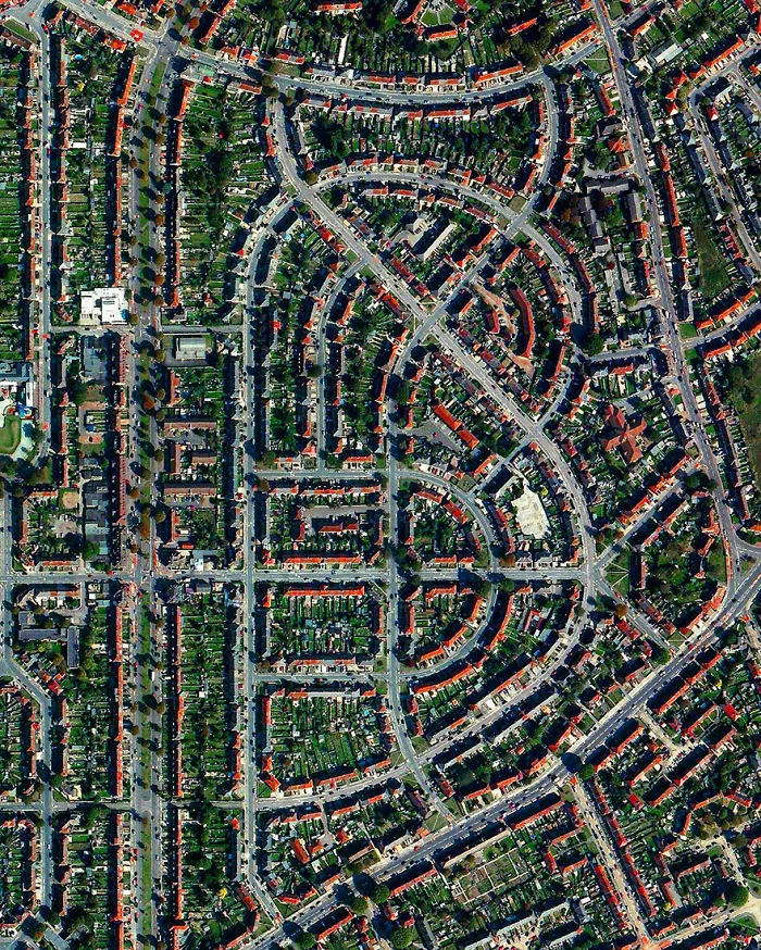
#90 Seattle-tacoma International Airport, Seattle, Washington, USA
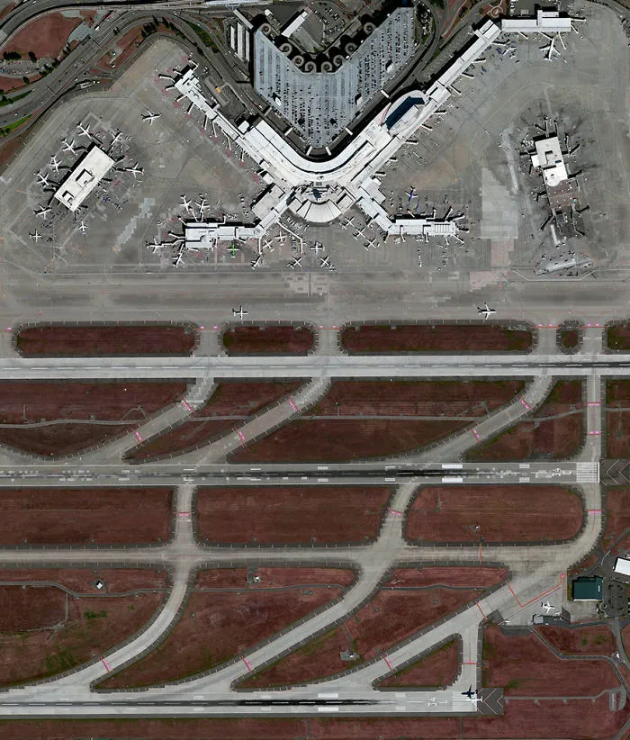
My flight to Seattle-Tacoma International Airport will be one of the roughly 380,000 aircraft movements that take place at the facility each year and I will be one of roughly 42 millions passengers that travel through the airport annually. The facility also contains a 13,000-car parking garage, the largest structure of its kind in North America, which is visible at the top of this Overview.
3points
#91 Stade De France, Saint Denis, France
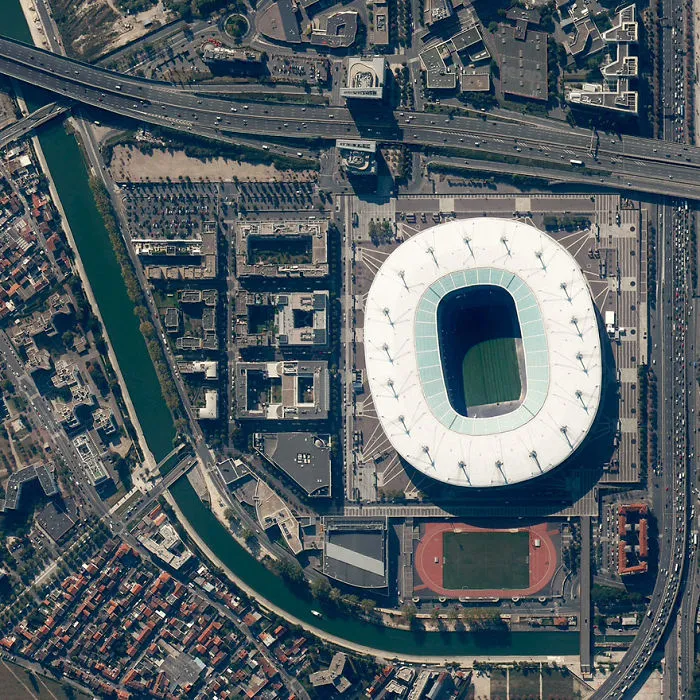
48°55′28″N 2°21′36″E. In a less than an hour, France will square off against Portugal in the finals of Euro 2016 — the championship tournament of European football (soccer) that takes place every four years. The match will be played in Stade de France, the nation’s largest stadium that has a seating capacity of 81,338. Enjoy the game!
3points
#92 Trujillo, Peru
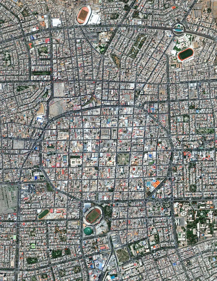
8°6′43.2″S 79°1′43.68″W. Trujillo is the second largest city in Peru with slightly less than 800,000 residents in its urban area. España Avenue - the circular road that is visible at the center of this Overview - contains the city’s monument area and also traces the historic outline of the defensive wall that was constructed around the city in 1786.
3points
#93 Montauk Point Light, Montauk, New York, USA
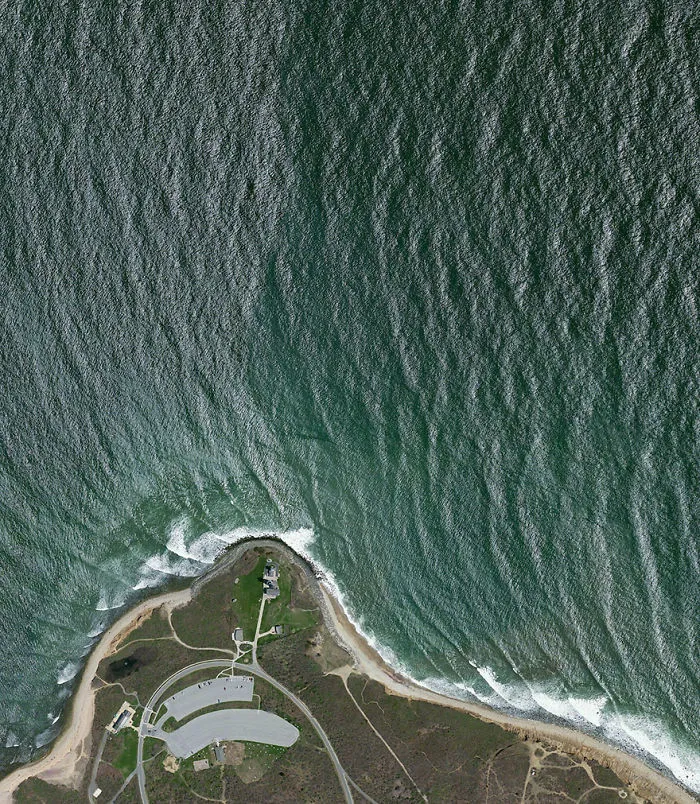
41°4′15.480″N 71°51′25.528″W. Montauk Point Light is a lighthouse located at the easternmost point of Long Island in the hamlet of Montauk, New York. With its construction authorized by George Washington in April 1792, the building was the first of its kind in New York and is the fourth oldest active lighthouse in the United States.
3points
#94 Caracas, Venezuela

10°30′N 66°55′W. Caracas is the capital and largest city in Venezuela, with more than three million residents. In recent months, plummeting oil prices combined with a significant drought has created a dire situation in cities across the nation. Four hour blackouts are now a regular occurrence and some regions go without power for days at a time. Most supermarkets have almost no food to sell, hospitals have no medicine, and crime is rampant and escalating.
3points
#95 Arlington National Cemetery, Arlington County, Virginia
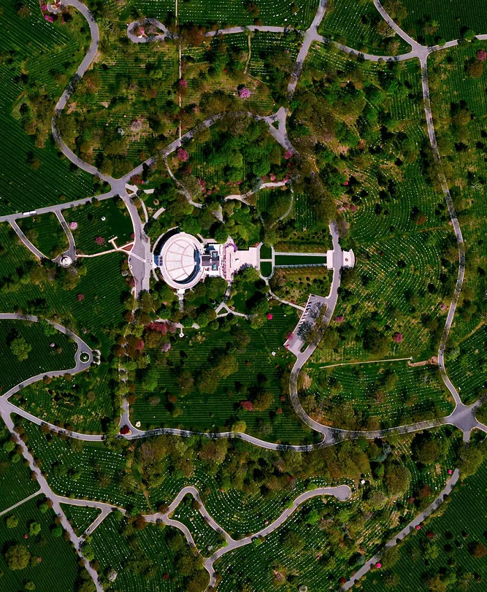
38°52′48″N 77°04′12″W. In honor of Memorial Day in the United States, we’ve selected an Overview of Arlington National Cemetery outside of Washington, D.C. Since the American Civil War, the 624-acre cemetery has become the final resting place for veterans of the nation’s conflicts. The structure seen here is the Arlington Memorial Amphitheater that also contains the Tomb of the Unknown Soldier.
3points
#96 Spaghetti Junction, Knoxville, Tennessee, USA
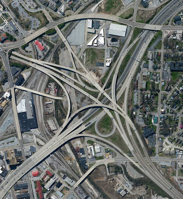
35.9663844, -83.929399. A highway interchange connect Interstates 40 and 275 outside of Knoxville, Tennessee, USA. Because of its intertwined construction, a structure like this is commonly called a “spaghetti junction.”
3points
#97 Miami Beach, Miami Beach, Florida, USA
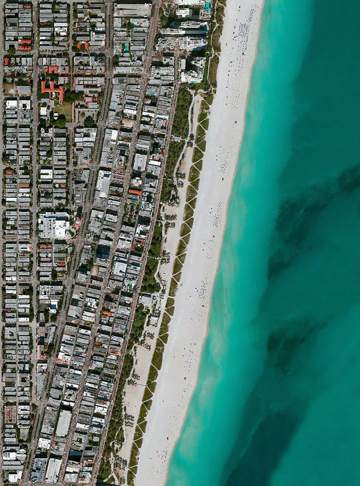
25.783742, -80.128644. Umbrellas and beachgoers dot the sands of Miami Beach, Florida, USA. This area is one of the most popular tourist destinations in the country, attracting nearly 15 million visitors each year.
3points
#98 Port Newark-elizabeth Marine Terminal, Newark, New Jersey, USA

40°40′54″N 74°09′02″W
3points
#99 Agricultural Development, Addis Ababa, Ethiopia

9°1′48″N 38°44′24″E
3points
#100 Spaghetti Junction (A-3 And M-50), Madrid, Spain
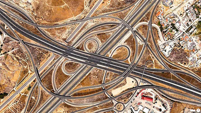
40.360051, -3.564548. The A-3 and M-50 highways come together in an interwoven crossroads southeast of Madrid, Spain. This structure is commonly called a “spaghetti junction.”
3points