




Photographer Benjamin Grant has set off on a mission to change the way we see our planet with his stunning photo project - Daily Overview.
Every single day, Grant shares one satellite photo from Digital Globes to change the way we see our planet. "With a focal length 16 times longer than a standard DSLR camera, the cameras are so powerful that you can take a picture of a beach ball on the Golden Gate Bridge in full resolution…from Los Angeles," Grant told Bored Panda. "I try to present the images with no bias and let people decide what these altered landscapes mean, based on the facts and the visual evidence in the frame. I believe that this perspective is a means to start a conversation about the condition of our planet and how we can better protect it."
"I create the images by stitching together numerous high-resolution satellite photographs. I partnered with a satellite company called DigitalGlobe and accordingly have access to their full archive of imagery. Once I have put together a composite image, I then treat it like a photograph to make it as crisp and easy to understand as possible to accentuate certain patterns, colors, or places." The results are so amazing, Grant has even put together a book of over 200 high-resolution satellite photographs. It's titled "Overview: A New Perspective of Earth", and can be purchased through Amazon.
This post may include affiliate links.
#61 The Bicycle Snake, Copenhagen, Denmark
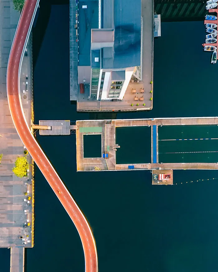
The Bicycle Snake (or Cykelslangen) is a 200-meter long ramp in Copenhagen, Denmark. The structure was created because 12,500 cyclists needed to bring their bikes up and down a large staircase each day. Instead of just replacing the staircase with a ramp, the architects proposed a plan with a new and beautiful approach to navigating the area. The Bicycle Snake now meanders 6-7 meters above the sea's surface and is painted in a bright orange color to increase visibility for cyclists.
9points
#62 Palm Island, Miami Beach, Florida, USA

25.783216°N 80.16052°W. Palm Island and Hibiscus Islands are two man-made islands located in Miami Beach, Florida. While the residential neighborhoods on the islands have some of the highest property values in the city, they are also among the first places ordered to evacuate in advance of a hurricane.
9points
#63 New Bullards Bar Reservoir, Yuba County, California
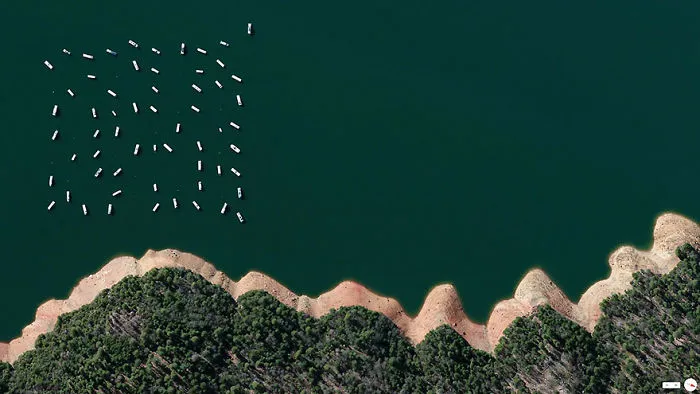
39.42903°N 121.13010°W
9points
#64 Dusable Harbor, Chicago, Illinois, USA

41.8798146,-87.618203. Sailboats are docked at DuSable Harbor in Chicago, Illinois, USA. The facility is located on Lake Michigan in the heart of the city’s downtown area and contains 420 slips for boats between 30 to 60 feet in length.
8points
#65 Los Angeles International Airport, Los Angeles, California, USA

33°56′33″N 118°24′29″W. This morning I’m flying to Los Angeles for a couple of days through the city’s international airport, commonly referred to as LAX. Last year, the facility handled nearly 75 million passengers, making it the seventh busiest in the world.
8points
#66 Hartsfield-Jackson International Airport, Atlanta, Georgia, USA

33°38′12″N 084°25′41″W. Hartsfield–Jackson International Airport in Atlanta, Georgia, USA is the busiest airport in the world by total passengers and number of flights. In 2015, ATL accommodated more than 101 million passengers and 882,000 flights. Dozens of planes departing and arriving at concourses A-D are seen in this Overview.
8points
#67 Halong Bay, Quảng Ninh Province, Vietnam
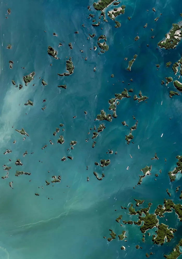
20°54′N 107°12′E. Hạ Long Bay, located in the Quảng Ninh Province of Vietnam, is a stunningly beautiful destination. Here, towering limestone pillars and tiny islands topped by a rich, green forest rise from the beautiful waters of the Gulf of Tonkin. Halong translates as 'where the dragon descends into the sea' and local legend suggests that this seascape was created when a great mountain dragon charged towards the coast, its flailing tail gouging out the valleys and crevasses in its path.
8points
#68 Port Of Shanghai, Shanghai, China

30°37′35″N 122°03′53″E. The Port of Shanghai is the world’s busiest container port, handling more than 35 million TEUs (approximately 776 million tons) of cargo every year. That weight is roughly equal to 1.7 times the mass of all humans living on the planet.
8points
#69 Central De Abasto, Mexico City, Mexico

19°22′26.07″N 99°5′18.38″W. Thousands of trucks and cars surround the Central de Abasto - Mexico City’s largest wholesale market for produce and other foodstuffs. The market serves more than 300,000 people and handles over 30,000 tons of merchandise each day —representing 80% of the consumption of the Mexico City metropolitan area.
8points
#70 Moscow Rings, Moscow, Russia

55°45′N 37°37′E. Moscow is the capital and largest city in Russia with 12.2 million residents. The city is organized into five concentric transportation rings that surround the Kremlin. The two innermost rings are seen here.
8points
#71 Neves-Corvo Mine, Castro Verde Municipality, Portugal

37°34′23″N 7°58′15″W. Waste ponds are seen at the Neves-Corvo Mine in the Castro Verde Municipality in Portugal. Zinc and copper and the primary resources extracted from the mine and the byproducts of that extraction is sent to these basins three kilometers away. Typically, once waste materials are pumped into a tailings pond, they are mixed with water to create a sloppy form of mud known as slurry. The slurry is then pumped through magnetic separation chambers to extract usable ore and increase the mine’s total output.
8points
#72 Venture Out Rv Resort, Mesa, Arizona, USA
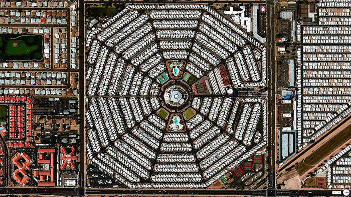
33.411791, -111.723591
8points
#73 Port Of Tanjung Priok, Jakarta, Indonesia

6.104°S 106.8865°E. Dozens of massive cargo ships and tankers - some weighing up to 300,000 tons - are anchored outside the Port of Tanjung Priok in Jakarta, Indonesia. The facility is the country's busiest and most advanced seaport, handling more than 50% of Indonesia's trans-shipment cargo. The port is also among the least efficient in all of Southeast Asia, due to slow customs handling and limited docking capacity.
7points
#74 Olympic Tennis Center, Rio De Janiero, Brazil

22.978822°S 43.396382°W
7points
#75 Judge Harry Pregerson Interchange, Los Angeles, California

33.9287°N 118.281°W. Today I'll be traveling throughout the freeway network of Los Angeles, well known for its massive interchanges (and traffic). The Judge Harry Pregerson Interchange is a stack highway interchange located near the Athens and Watts neighborhoods in South LA. This junction is composed of five levels that scale to a staggering height of more than 40 meters (132 feet).
6points
#76 Maggie Daley Park, Chicago, Illinois, USA

41°52′57″N 87°37′08″W. This Overview shows Maggie Daley Park in Chicago, Illinois, USA. The park’s Buckingham Fountain stands out in this Overview with its ornate design and serve as a gathering point for thousands of visitors at the Lollapalooza festival this weekend.
6points
#77 Port Of Rotterdam, Holland

From 1962 until 2002, Rotterdam was the world’s busiest port, but was overtaken first by Singapore and later by Shanghai.
6points
#78 Jeongwang-Dong, Ansan, South Korea

37.336147372°, 126.718586767°. Jeongwang-dong is an industrial sector in the city of Ansan, South Korea. The Korean government intensively drove a plan to develop the modern city, particularly in this area, with an emphasis on manufacturing. The striking blue color that you see here results from the use of aluminum roofing, which is used for its low cost and longevity.
6points
#79 Amazon Rainforest Deforestation, Para, Brazil

5°40′S 52°44′W. Clearcutting operations in the Amazon Rainforest of Para, Brazil branch out from one of the state’s central roads.
6points
#80 Port Of Los Angeles, Los Angeles, California, USA
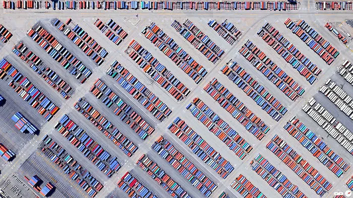
33°43′45″N 118°15′43″W
6points