




The oldest maps out there are roughly 4000 years old, depicting a section of the river Odet valley in modern Finistère, Brittany. It was found in a tomb, possibly to communicate to people what its inhabitant “controlled.” The fact is that all through history, humans have been trying to make records of the world around them in interesting ways.
The “Simon shows you maps” Facebook page, run by the titular Simon, is dedicated to sharing cool and interesting maps. So get comfortable as you scroll through, upvote the best ones and be sure to share your thoughts and ideas in the comments section down below.
More info: Facebook
#41

The very low birth rates across Europe lock in future population decline now. The Mediterranean countries will be pretty empty. Well, except for the summer months when everyone still comes to Italy and co for a holiday.
Report
14points
#42 Holidaymakers In The Mediterranean Should Study This Map Carefully To Impress (Annoy?) Their Friends And Family With Island Related Geography Trivia!

Report
14points

#44 Most Of Europe Is Shrinking As Is. Without Migration The Shrinkage Would Be Huuuge By 2100

Report
13points

#46 That's One Way Of Saying That Poland Really Saw Impressive Economic Growth In Recent Years

Report
13points

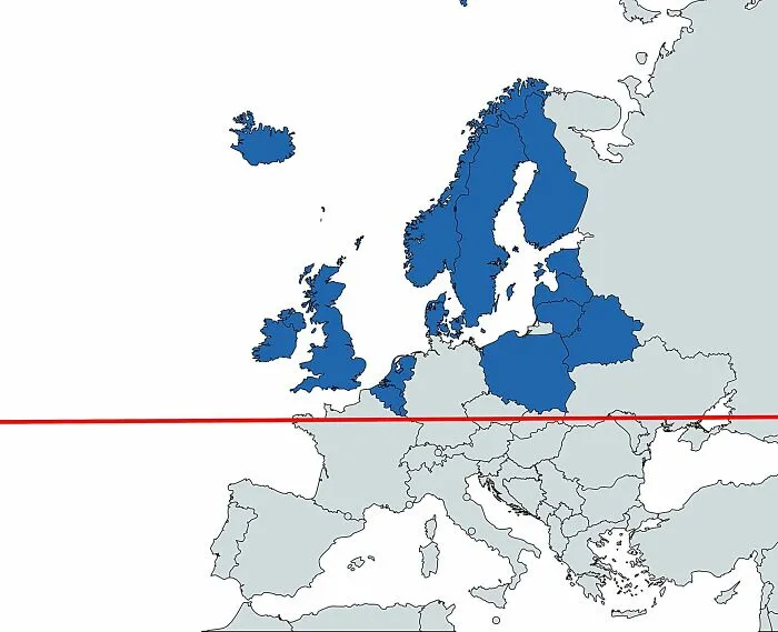
#48 This Map Overlays The 49th Parallel (Essentially The Us–canada Border) On Europe
Report
13points

