



Bored Panda
99 Fascinating Maps That Explain The World Better Than Any Spreadsheet (New Pics)

99 Fascinating Maps That Explain The World Better Than Any Spreadsheet (New Pics)

37
1
Numbers and geography. Neither, as my family never tires of pointing out, is exactly my strong suit. A spreadsheet? My eyes glaze over instantly. Need directions? You’re better off staying home than listening to me. Maps, however, are a bit of a different story. Maybe it’s because a good map does the hard work for you. Take a pile of data that would normally send me running, add a few colors, and suddenly order is restored to the world (or at least the part of it on the map). And it’s not all navigation, either.
Turns out some maps even reveal all sorts of curiosities you never knew you wanted to know about, like which European countries use a comma instead of a decimal point, where it’s illegal to boil a lobster alive, or how many hours you’d have to work to buy GTA VI, depending on where you live. So whether you’re a geography buff or someone who, like me, still gets lost on the way to the shops, here are some of the most fascinating maps out there, plus some expert insight from Philippa Irvine, a geography lecturer at Rhodes University in South Africa.
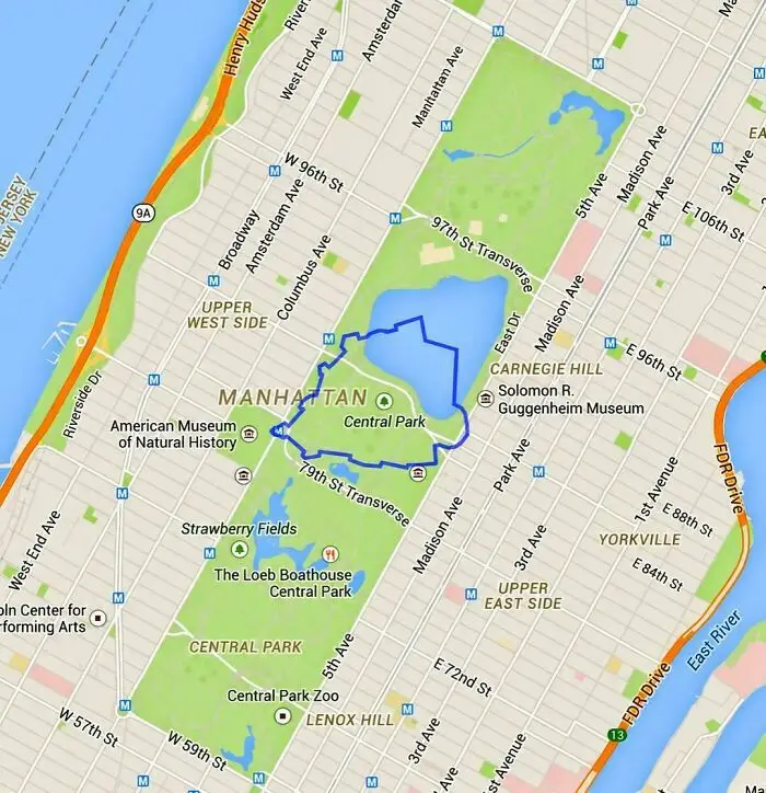
#61 The World's Smallest Country Compared To Central Park

Detailed map of Central Park Manhattan illustrating intriguing geographic layouts to explain the world.
5points

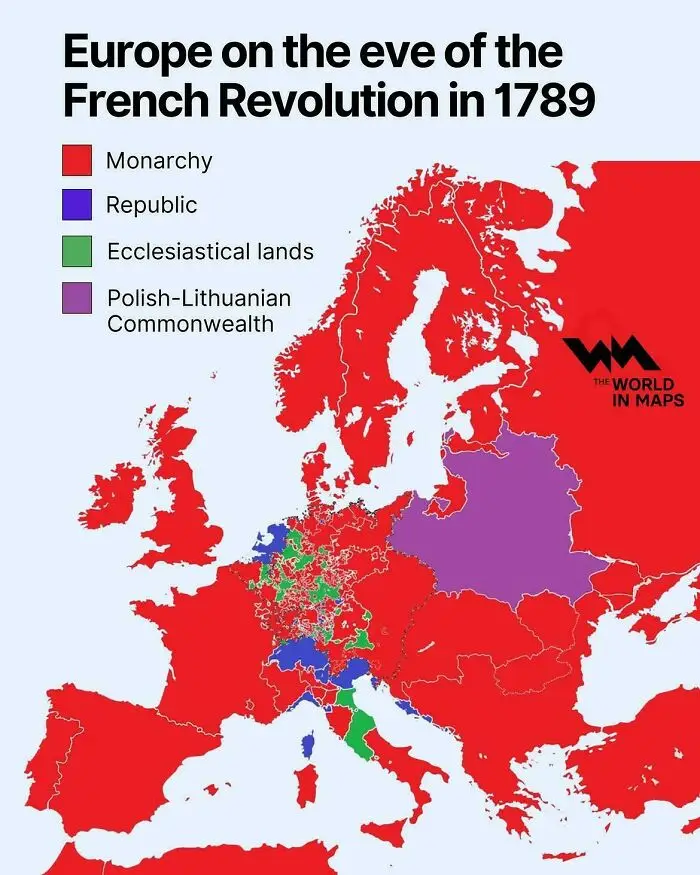
#62 Europe On The Eve Of The French Revolution In 1789

Map of Europe in 1789 showing government types before the French Revolution, among fascinating maps.
5points

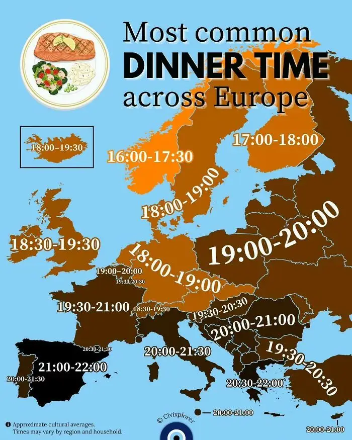
#63 Most Common Dinner Time Across Europe

Map displaying common dinner times across European countries, featured in fascinating maps that explain the world.
5points

#64 Mapped The Exact Coastal Land Napoleon Offered To San Marino In 1797 (Which They Famously Declined To Avoid Making Enemies)
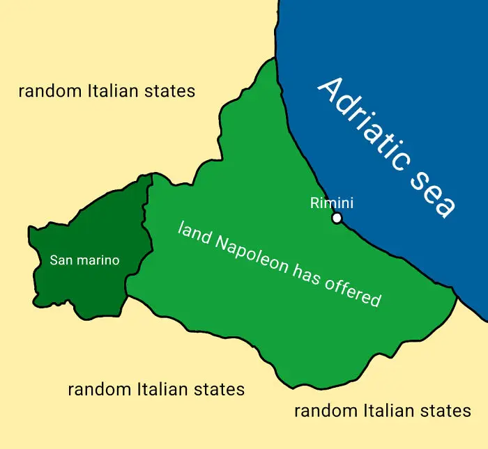
Historical map showing San Marino and land offered by Napoleon, part of fascinating maps that explain the world.
Report
5points

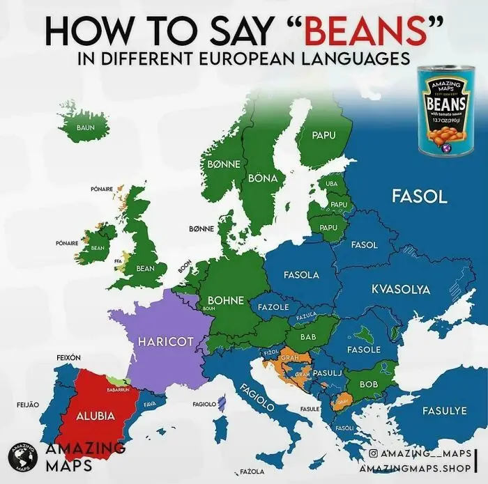
#65 How Do You Say "Beans" In Different European Languages

Linguistic map of Europe showing words for beans in various languages, among fascinating maps that explain the world.
5points

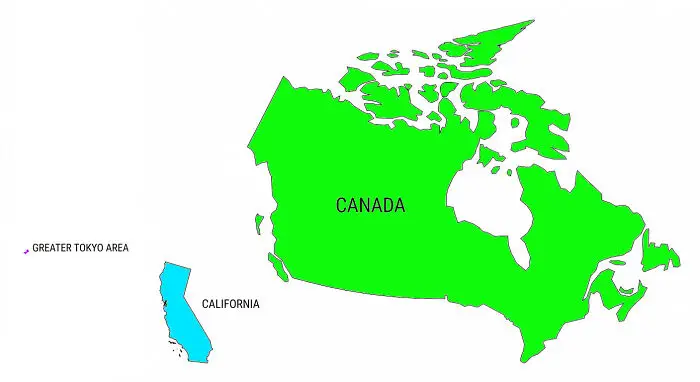
#66 These Three Places All Have About The Same Population Size

A size comparison map showing Canada, California, and the Greater Tokyo Area
5points

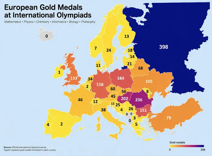
#67 European Gold Medals At International Olympiads

A map of Europe displaying gold medals won by each country at international scientific olympiads.
Report
5points

#68 Antarctica Ejects Anomalously Cold Temperatures Towards South America
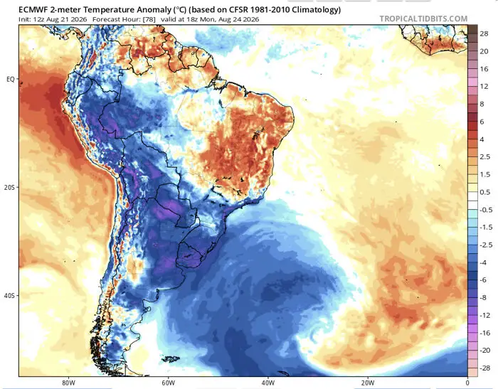
Fascinating map displaying a temperature anomaly forecast across South America with heat and cold zones.
5points

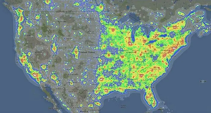
#69 Light Pollution Across The United States

Fascinating map showing light pollution levels across North America, illustrating human activity clearly.
5points

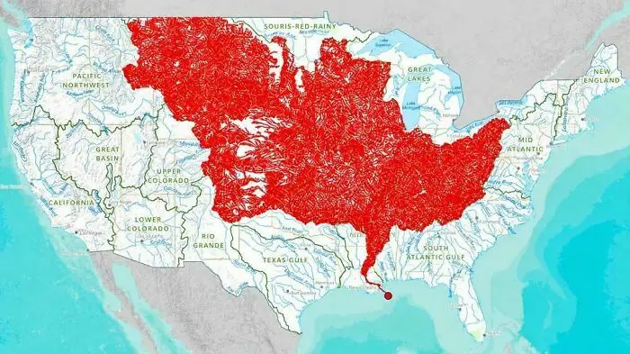
#70 The 7000 Rivers That Feed Into The Mississippi

Detailed map of the US highlighting river basins in red, an example of fascinating maps that explain the world.
5points

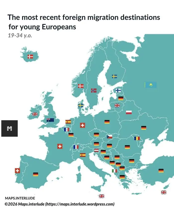
#71 The Most Recent Foreign Migration Destinations For Young Europeans

European country map displaying top foreign migration destinations for young Europeans as part of fascinating maps.
5points

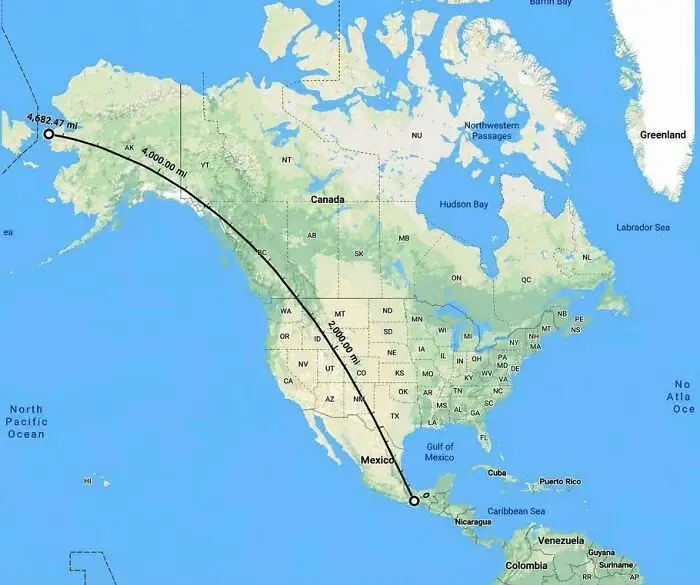
#72 The Longest Straight Line You Can Walk In The Americas

Fascinating maps display showing a straight geographic distance line drawn across North America from Alaska to Mexico.
5points

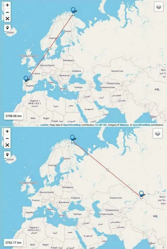
#73 From Vardø, Norway, It's Closer To China Than Portugal

Side-by-side maps showing flight route distances across Europe and Asia with red trajectory lines.
5points

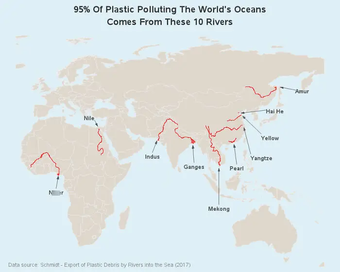
#74 95% Of Ocean Plastic Comes From Only 10 Rivers

A map showing 10 rivers responsible for 95 percent of ocean plastic pollution, highlighting key global rivers in red.
5points

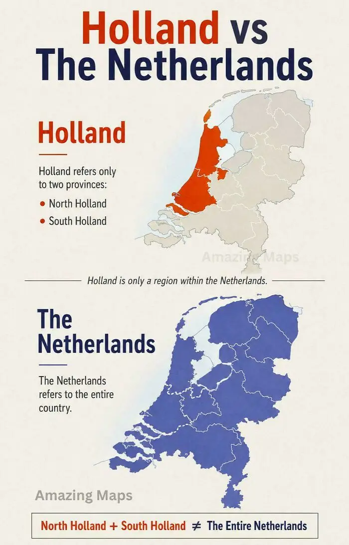
#75 Holland vs. The Netherlands

Educational map explaining the geographical difference between Holland and The Netherlands.
4points

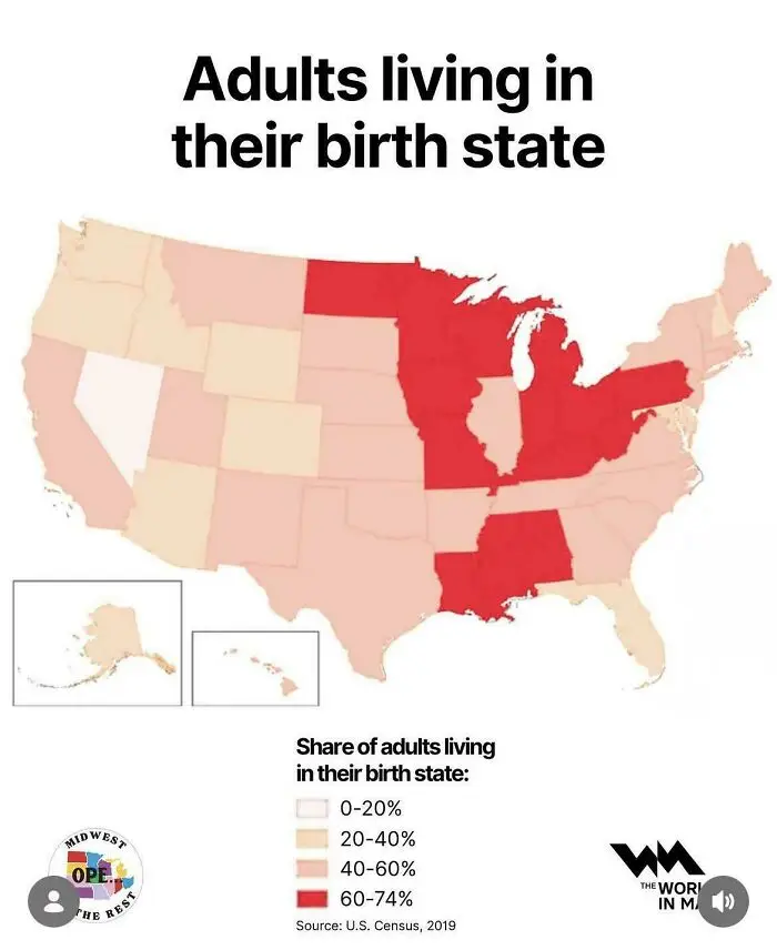
#76 Adults Living In Their Birth State (US)

US map showing the percentage of adults living in their birth state.
4points

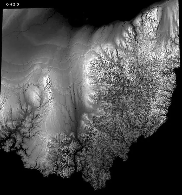
#77 Ohio's Elevation Map Reveals Where The Glaciers Stopped

A black and white topographic relief map of Ohio showing terrain variations, serving as a fascinating map.
4points

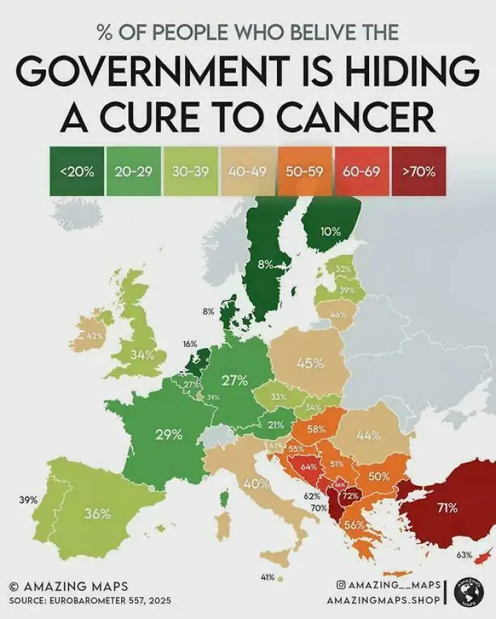
#78 People Who Believe The Government Is Hiding A Cure To Cancer

A European infographic map displaying percentages of belief in government cancer cure conspiracies.
Report
4points

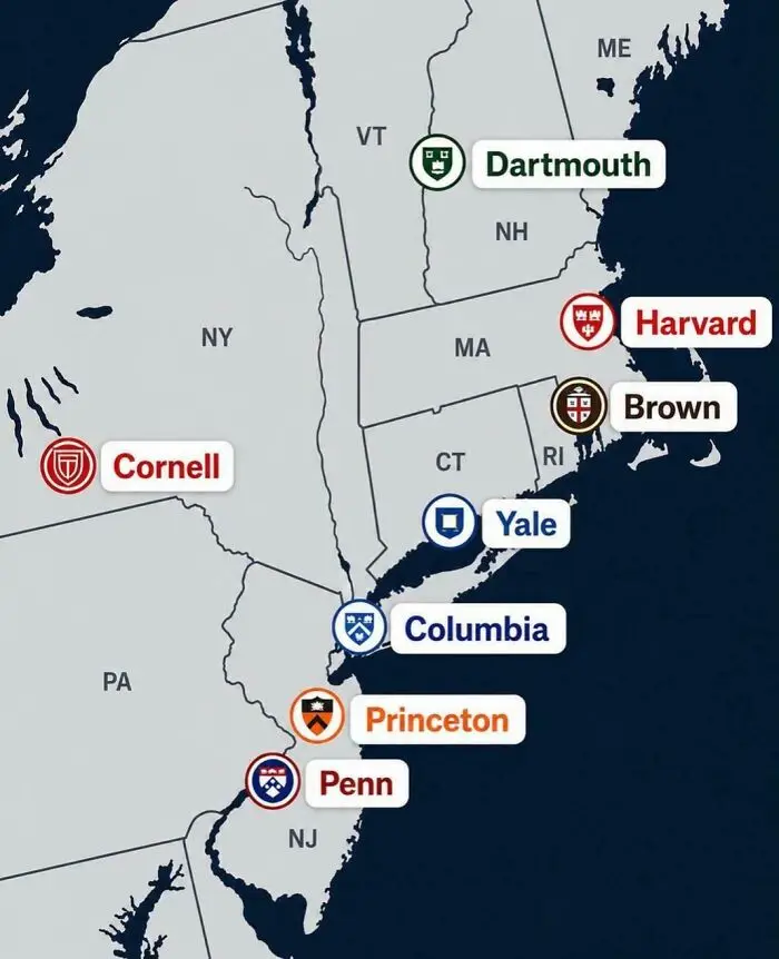
#79 The Locations Of America's Ivy League Universities

A map showing locations of Ivy League universities in the northeastern United States.
4points

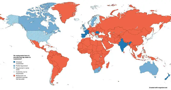
#80 Legal Obligation To Provide Free Tap Water In Restaurants

A world map illustrating global restaurant policies on providing free tap water to customers.
4points
37
1