



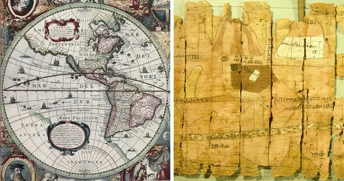


Easily navigating the world is one of the greatest gifts to the modern world. We developed tools to help with that, and one thing stands above all—a map. Throughout history, ancient maps of the world have been invaluable exploration tools. From the artistic designs of medieval maps to the earliest known primitive representations of the globe, these charts offer a glimpse into ancient history and our ancestors' evolving understanding of our planet.
Beyond their practical usefulness, these maps could also considered unusual works of art. The artistry and craftsmanship that created these complex illustrations of our world is something else. Each map is a tribute to the creativity and skill of its maker, offering us a window to see the cultures and societies that existed before us.
Ancient world maps are not just documents of geography but also evidence of human creativity and advancement. With each discovery and technological progress, maps had to be updated. The first map of the world was a starting point, and generations of cartographers improved and expanded upon these early models.
Now, it's your turn to explore these ancient world maps. Delve into the past and marvel at the creativity and artistry of these charts. Share with friends and family, and let them participate in this voyage through time and the world!
#21 Mercator World Map

A cylindrical map projection, known as the Mercator projection, was first used in a globe map by Flemish geographer and cartographer Gerardus Mercator in 1569. The Mercator projection distorts the size and shape of large objects as the scale increases from the Equator to the poles, where it becomes infinite, whereas the linear scale is constant in all directions around any point, preserving the angles and shapes of small objects (which makes the projection conformal).
Report
11points
#22 Tabula Rogeriana

The Tabula Rogeriana by Al-Idrisi, drawn in 1154. Based on the accounts of Arab traders who had traveled the globe, this map was produced. It was the world's most detailed and accurate map at the time. The map displays a lot of Europe and Asia, but it only shows the northern regions of Africa.
10points
#23 De Virga World Map

Albertinus de Virga created the De Virga world map between 1411 and 1415. A 1409 map of the Mediterranean region, similarly produced in Venice, is credited to Venetian Albertin de Virga. A circular global map measuring 69.6 cm by 44 cm (27.4 in x 17.3 in) has been drawn on parchment. It comprises of the actual map, which measures 44 cm (17 in) in diameter, plus an addition that includes two tables and a calendar.
Report
10points
#24 The Anglo-Saxon Cotton Map

The Anglo-Saxon Cotton Map, created between 1025 and 1050 AD. The highest region of this map is made up of the eastern regions of the earth. By misinterpreting descriptions of the Red Sea, the artist mistakenly painted every river in Africa red.
9points
#25 Dura Europos Route Map

Dura-Europos parchment, showing a part of the Black Sea coast, around 200 AD. It was found in 1923 by F. Cumont in Syria.
Report
9points
#26 Piri Reis Map

The Piri Reis map was produced by Ottoman Turkish admiral and geographer Piri Reis in the 16th century. The third of the map that has survived depicts parts of the western coasts of Europe and North Africa rather accurately, and the Brazilian coast is also clearly visible. The mythical island of Antillia, as well as several other Atlantic islands, including the Azores and Canary Islands, are pictured. The map is notable for showing what appears to be an extension of the American continent to the southeast, which some have argued is proof that Antarctica was known to exist before other continents.
Report
9points
#27 World Map By Cosmas Indicopleustes

World map by Cosmas Indicopleustes from the sixth century, which shows the globe as a rectangular-shaped surface.
Report
8points
#28 Map Of The Track Of Yu Gong

Around Shaanxi, China, in the year 1137, a stone was engraved with the "Map of the Track of Yu Gong."
This precisely drawn map, which shows the size of the Chinese empire, was created using a rectangular grid.
Report
8points
#29 Map From Mahmud Al-Kashgari's Diwan
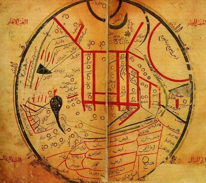
The world map was created by Mahmud al-Kashgari in the eleventh century. The ancient city of Balasagun, which once stood where Krygyzstan does today, is the focal point of this map. It contains locations like Gog and Magog that are said to make an appearance in the end times.
Report
8points
#30 The Psalter World Map

The Psalter World Map, drawn by an unknown medieval monk in 1260 AD. Maps from this time period usually place the east at the top of the globe, where the sun rises and Jesus watches over the world.
Report
8points
#31 Pietro Vesconte's World Map

Pietro Vesconte, an Italian geographer, drew this map of the world in 1321. After centuries of T and O designs, Vesconte restored precision to maps by utilizing nautical charts to map the seas.
Report
8points
#32 The Kangnido World Map

The Kangnido World Map was created by Korean officials in 1402 AD. The Joseon Dynasty combined Chinese maps with information about the West that they learned from Mongolian Muslims to create this map.
Report
8points
#33 The Genoese Map

The Genoese map was created in 1457 based on Niccolo da Conti's descriptions. After the first commercial connections between China and Mongolia were established, this map illustrates a developing European understanding of the Asian continent.
Report
7points
#34 Gerard Van Schagen's Map Of The World

The world map created in 1689 by Gerard van Schagen. With the exception of a few ambiguously blank areas in the Americas, most of the planet had by this point been mapped.
Report
7points
#35 World Map Of Pomponius Mela

Pomponius' world map, created in 43 AD.
7points
#36 Catalan World Atlas

The Catalan World Atlas was produced by the Majorcan cartographic school and is attributed to Cresques Abraham. The texts on the first two leaves are in Catalan and deal with cosmology, astronomy, and astrology. Illustrations are included with these texts. The spherical shape of the Earth and the current status of the known globe are emphasized in the words and illustrations. They also teach sailors how to tell time at night and about tides.
Report
7points
#37 Borgia World Map

The Borgia map is an early 15th-century world map that is mostly decorative. It was engraved on a metal plate.
Report
7points
#38 Caverio Map

Nicolay de Caveri drew the Caverio Map, also known as the Caveri Map or Canerio Map, sometime around 1505. It was most likely drawn in Lisbon by the Genoese cartographer Canveri and it's eerily similar Cantino map in Genoa. It was one of the primary resources used to produce the Waldseemüller map in 1507 and provides a remarkable amount of information regarding the east coast of North America.
Report
7points
#39 Hecataeus Of Miletus' Map Of The World

The world map created by Hecataeus of Miletus in the fifth or sixth century BC.
Around the Mediterranean Sea, Hecataeus divides the world into three regions: Europe, Asia, and Libya. His planet is a round disc encircled by water.
Report
6points
#40 World Map By Beatus Of Liébana

Beatus of Libeana, an Asturian monk who lived in the eighth century AD, created this view of the universe. Based on the T and O pattern, Beatus's map is referred to as a "Christian Map."
Report
6points


