







Spending a Friday night in a sewer may not be to everybody's tastes, for obvious reasons. To a photographer, however, the wonders that lay beneath the ground can offer unique environments that are both fun to explore and incredible subjects to light. A cross-section of most cities would reveal all manners of engineering projects; buried rivers, service tunnels, reservoirs, sewers, air-raid shelters, and who knows what else. All either disused or quietly and modestly fulfilling their intended purposes in the dark, too deep in the earth for the rays of glory to reach them.
We are able to look up at the world around us and the worlds above us, but what lies beneath us is, for the most part, hidden out of sight and out of mind. This can leave us with the false impression that we are standing on solid ground, when in fact millennia of human activity has bored more holes through the earth than we could ever be aware of. At the time when these structures become obsolete, it isn't practical to demolish and replace them, like their cousins on the surface. They are often capped off and left for the next generation to deal with, becoming the tombs of the ideas and technologies that formed them.
Taking some time to learn about the subterranean delights beneath your feet can add another fascinating dimension to your perception of the world in which you live. Let's shine some light through the portal and take a look at a few examples of what can be found. Subterranean exploration comes with significant risk. Don't attempt to enter any holes in the ground without being aware of the dangers.
#21 Željava Air Base
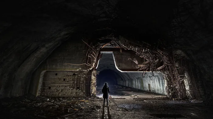
Standing at one of the sliding blast doors at the entrance to the Željava Air Base in Croatia, the force of the blast that destroyed the facility is quite plain to see. The 56 tons of explosives laid by the retreating army of Serbian Krajina parted the 2” steel rebar like lace, tore the 100-ton door in two and sent half of it into the opposite wall of the tunnel, some 20 meters away. Locals have said that the ground shook violently for miles around and black smoke poured from the mouths of the tunnels for six months after the event.
The hazards in this location pose a threat to visitors like no other in this article. Landmines litter the grasslands of the airfield and woods of the mountain above; toxic chemicals line the collapsing walls underground and munitions lie scattered across the floor. Bears are frequent visitors here, often hanging around over winter to hibernate in the steady climate of the tunnels. Furthermore, the destruction of a large number of smoke detectors has dispersed traces of the radioactive element Americium throughout. The dangers present are not to be underestimated and it’s quite likely the Croatian Police will be there when you arrive, to remind you of that.
18points
#22 Batterie Todt
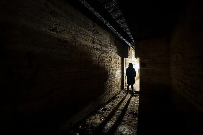
As the Germans dug in on the far shores of the English Channel, Hitler’s Atlantik Wall was bolstered by the construction of a gargantuan Naval gun battery on France’s north coast in 1942. Batterie Todt consisted of four 380-millimeter guns protected by concrete casemates with walls a whopping 3.5 meters thick. The guns each had a range of 55km; making them quite capable of throwing their shells over the channel, to plant them in the garden of England.
Three of the huge bunkers have been abandoned since the war and one is now being used as a museum with some interesting exhibits from the period. Beneath the gun emplacements are extensive underground magazines with doorways shaped to fit the enormous 15-inch shells; traversed along with the ceiling on rails as they headed towards the breech. A human silhouette gives some sense of the scale of these fearsome projectiles which rained upon Kent until the battery’s capture in September 1944.
16points
#23 London Sewers
Until the 1850s, London’s sewerage system consisted of the unregulated dumping of effluent into the River Thames or any other watercourse that would wash it away. An unsurprising rise in disease, including recurring cholera epidemics, added pressure on the authorities to take action against the growing number of deaths. Piles of sewage lined the river banks for decades until the ‘big stink’ in July of 1858. An unusually hot summer brought a heatwave which lifted the aroma of the raw sewage to a level unbearable by the city’s population. The false belief that cholera originated in sewage and was spread through the atmosphere in a ‘miasma’ led to the realization that something had to be done to solve the problem.
A proposal from an engineer named Joseph Bazalgette was accepted, which would have London equipped with interconnecting pipes, draining the sewage into East London, where it would be treated and released into the Thames, downstream of the city. The mammoth project ran from 1859-1875 and created some of the most wonderful structures of the Victorian age, such as Abbey Mills Pumping Station. Bazalgette would later be heralded as a hero for saving an immeasurable number of lives (albeit through dispersing the pathogen, not the miasma) and for pioneering a system that would later be adopted by cities across the world.
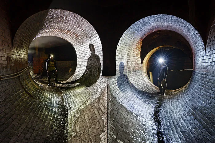
This photograph shows the intersection of two streams of sewage in a combined sewer overflow; designed to collect and divert rainwater runoff to prevent the main system from being overloaded. The beautiful brickwork of the sewer here is preserved as well as the day it was laid.
16points
#24 Radar Bunker
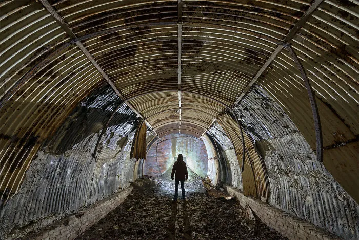
This cute bunker from the second world war would have provided accommodation for the crews of an early type of RADAR system on the south coast of England. The position is located just a stone's throw from where the Chain-Home early-warning system was pioneered, at RAF Langston Matravers in Dorset.
Aerials positioned on the top of the hill would detect incoming aircraft then transmit information to crews in protected bunkers nearby. One of these structures have been repurposed to house mobile antenna switchgear, whilst this bunker now shelters the sheep and cows of the nearby farm.
15points
#25 Monkton Farleigh
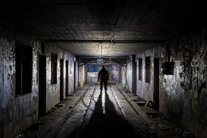
In an area famous for its stone mining industry and resultant caverns, the British government planned to utilize a series of disused mines for the storage of large volumes of RAF munitions in WW2 before their onward journeys to Germany. The chosen site at Monkton Farleigh provided a pre-tunneled area of 80 acres, which when complete, became the largest Central Ammunition Depot in the UK.
Served by six discrete entrances on the surface, the depot had a 1.25-mile tunnel constructed for the safe and inconspicuous movement of munitions from nearby railway sidings on the UK mainline. A long conveyor belt carried the ordnance up the length of the inclined tunnel towards the enormous storage districts.
This view shows the underground sidings and sorting yard and the bottom of the tunnel, where the munitions would be loaded from trains onto wagons, then onto the conveyor belt on their way into storage. At its peak, the yard was able to process up to 1000 tons of ordnance each day. This figure helps give some scale to the massive depot which is now used for secure data storage.
15points
#26 Deep Level Air Raid Shelter
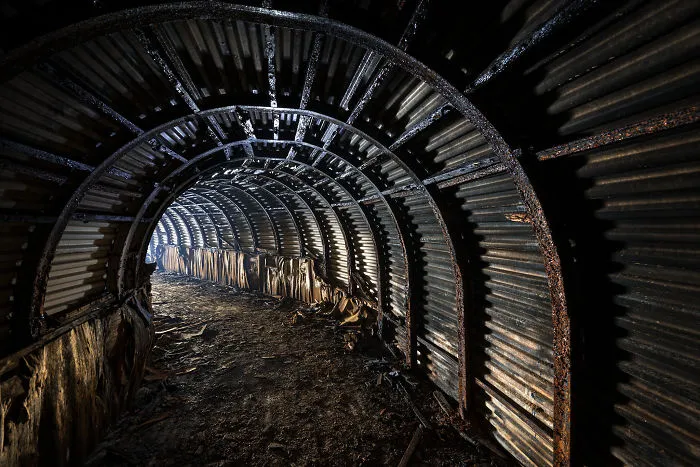
Another of Dover’s deep-level air raid shelters, this tunnel was dug in 1941 for the crews of a coastal artillery battery positioned on the cliffs to the West of the town. Designated a fortress in itself, this battery consisted of three 6” naval guns with a range of 24 km. With regular incoming fire from across the channel, the shelters saw frequent visitors during the first years of world war two.
As with the Z-Rocket Deep Shelter and so many other shelters in the area, the tunneling was performed by the 172nd Tunneling Company using steel girders and sheeting to line the walls. Still busy digging into WW2, this company had been made infamous by the heroic mining raids of WW1, quietly tunneling under the german lines to destroy and disorientate their enemy from below.
Since the entrances to the shelter were bulldozed, only the emergency escape route remains accessible. The small, backfilled and partially collapsed tunnel is located on a sheer and deadly cliff face, overlooking the sea.
14points

