
Bored Panda
35 Informative Maps People Shared On This Group That Might Change Your Perspective On Things (New Pics)

35 Informative Maps People Shared On This Group That Might Change Your Perspective On Things (New Pics)

0
1
Where would you start if you were looking for a treasure? Well, from what we learned in Jumanji, we probably need a map. In fact, maps, the precious representation of information, are key to so many secrets of the world, whether it’s the Earth, our history, politics, sociology, or anything, really.
Thanks to this corner of Reddit known for being the ultimate destination for fans of cartography, we can devour an endless variety of maps that all differ in information, style, size and other features. With 1.8 million members of the community, it’s now turning into one of those Reddit powerhouses that gives the best of online content.
Scroll down through the new batch of maps below and after you’re done, be sure to share our previous posts with the most unique and informative diagrammatic representations you may not have even known existed, here, here and here.

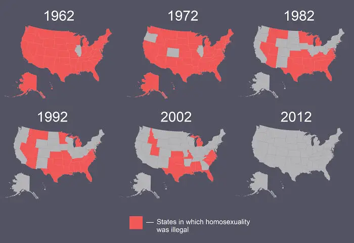
#21 US States In Which Homosexuality Was Illegal From 1962 To 2012

US map series showing the decline of states where homosexuality was illegal from 1962 to 2012, an informative perspective map.
1point

#22 Map Of The 2191 Meter Deep Krubera Cave. The Deepest Known Cave System In The World
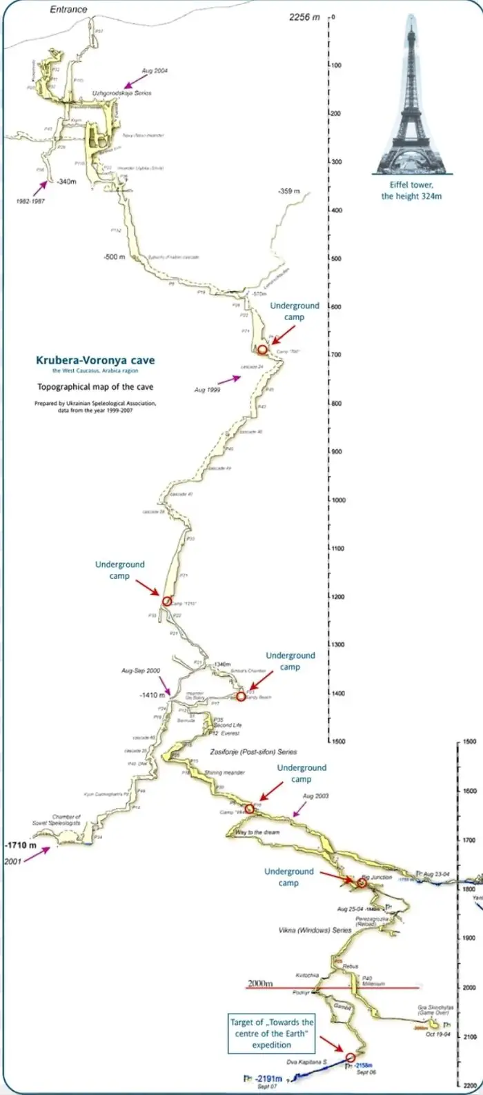
Topographical map of Krubera-Voronya cave showing underground camps and depth compared to the Eiffel Tower height.
Report
1point

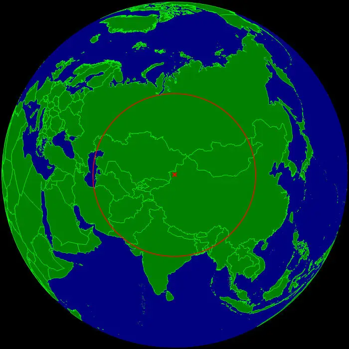
#23 This Is The Farthest Place On Earth From Any Ocean

Map showing a red circle centered in Asia illustrating geographic distance and perspective on a global scale.
Report
1point

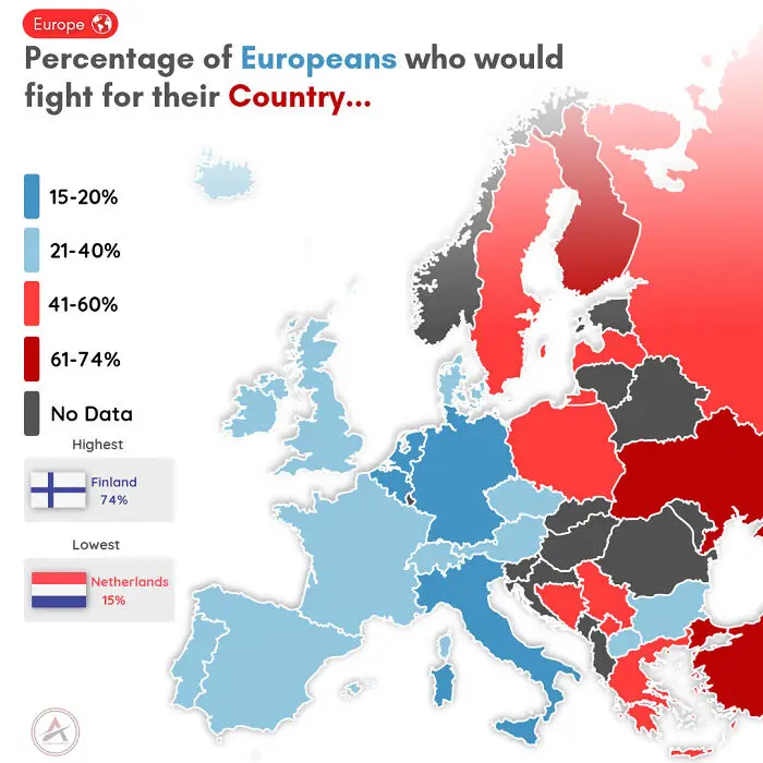
#24 % Of Europeans Who Would Fight For Their Country

Map of Europe showing percentage of Europeans willing to fight for their country, highlighting Finland highest and Netherlands lowest.
1point

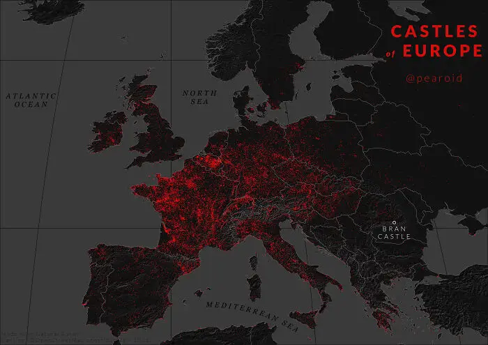
#25 Map For Halloween - Every Castle In Europe

Map showing castles of Europe highlighted in red, an informative map that might change your perspective on things.
1point

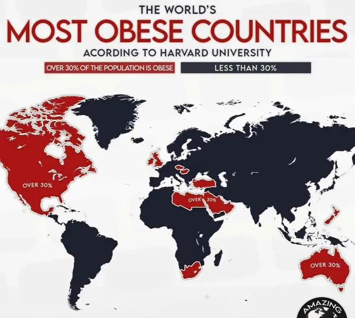
#26 Most Obese Countries

World map highlighting countries with over 30% obesity rates, showing global data on most obese countries by Harvard University.
Report
1point

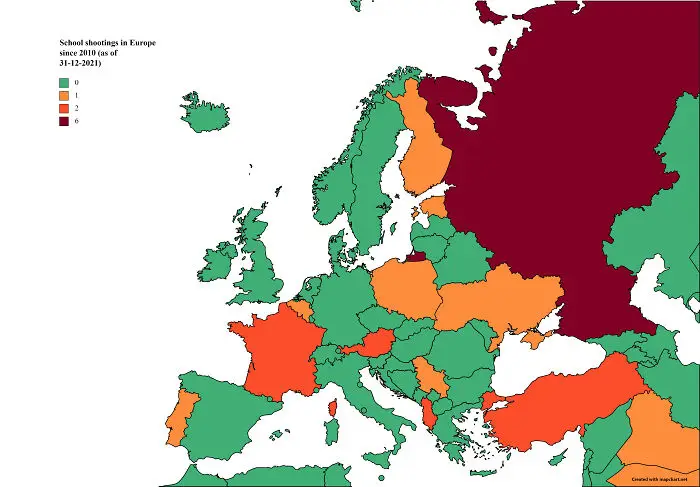
#27 School Shootings In Europe Since 2010

Map of Europe showing school shootings by country since 2010 with color-coded data revealing regional patterns and differences.
Report
1point

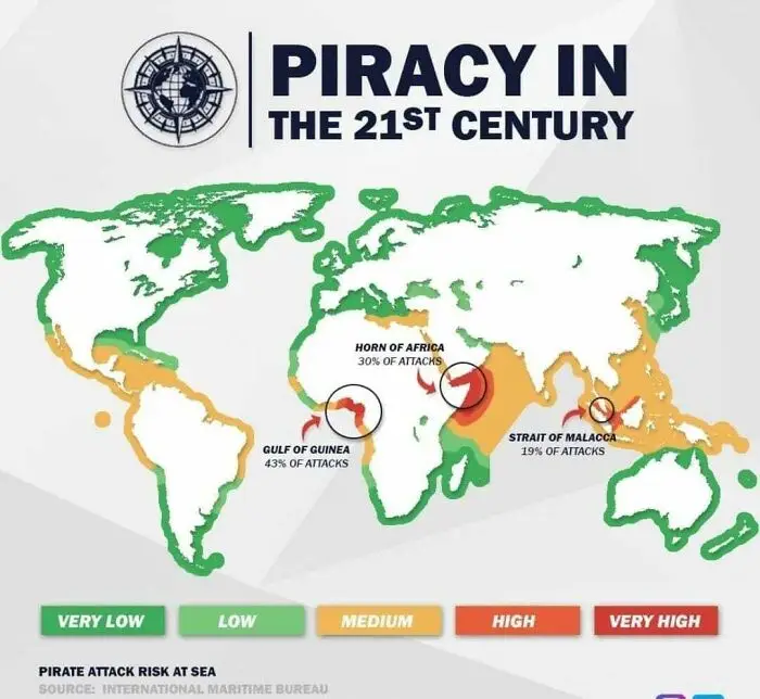
#28 Piracy In The 21st Century

World map showing piracy attack risk zones in the 21st century with Gulf of Guinea highest on informative maps.
1point

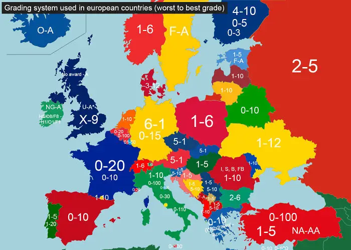
#29 Grading System In Europe

Map showing grading systems used across European countries with varied scales, offering an informative perspective on educational differences.
1point

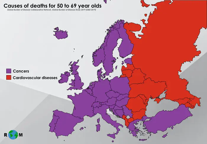
#30 Most Frequent Causes Of Deaths For 50 To 69-Year-Olds. @realworldmaps

Map showing causes of deaths for 50 to 69 year olds in Europe by cancers and cardiovascular diseases.
1point

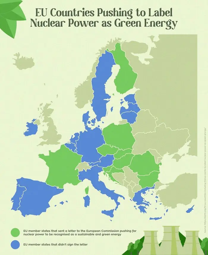
#31 Eu Countries Pushing To Label Nuclear Power As Green Energy

Map showing EU countries pushing to label nuclear power as green energy with states highlighted by support or opposition.
1point

#32 All Roads Lead To Rome. This Map Is Visualises The Famous Roads Built By The Roman Empire
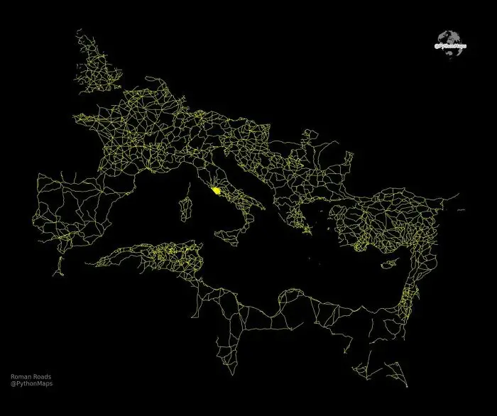
Informative map showing ancient Roman roads across Europe and the Mediterranean, highlighting historical infrastructure connections.
Report
0points

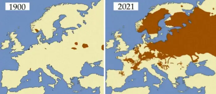
#33 Beavers In Europe, 1900 And 2021

Comparative informative maps showing territorial changes in Europe between 1900 and 2021 highlighting historical perspective shifts.
0points

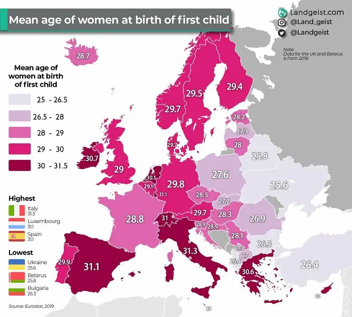
#34 Age Of Women At Birth Of Their First Child (Europe)

Map showing the mean age of women at birth of first child across Europe with varying age ranges and country comparisons.
0points

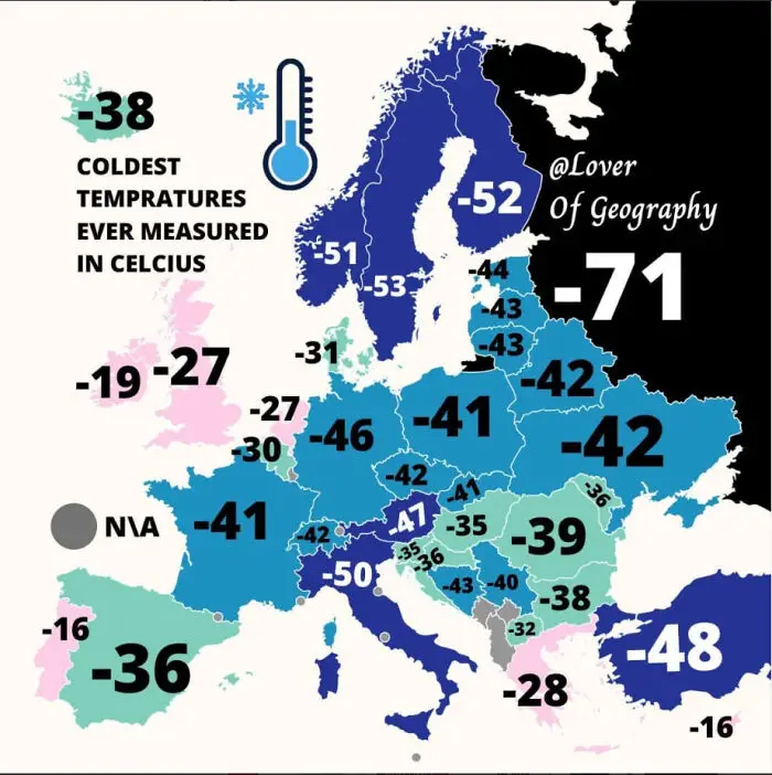
#35 Map Presenting Coldest Temperatures Ever Measured In Celcius...

Map showing coldest temperatures ever measured in Celsius across Europe with color-coded countries and temperature values.
0points

Add New Image

Not your original work?

0
1
Asli Akalin
Asli AkalinBoredPanda Staff