



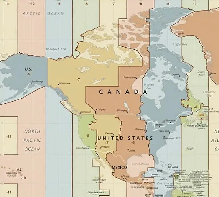
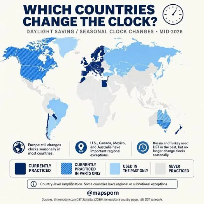
#21 Why Is There Such A Massive Time Zone Misalignment In Western North America?
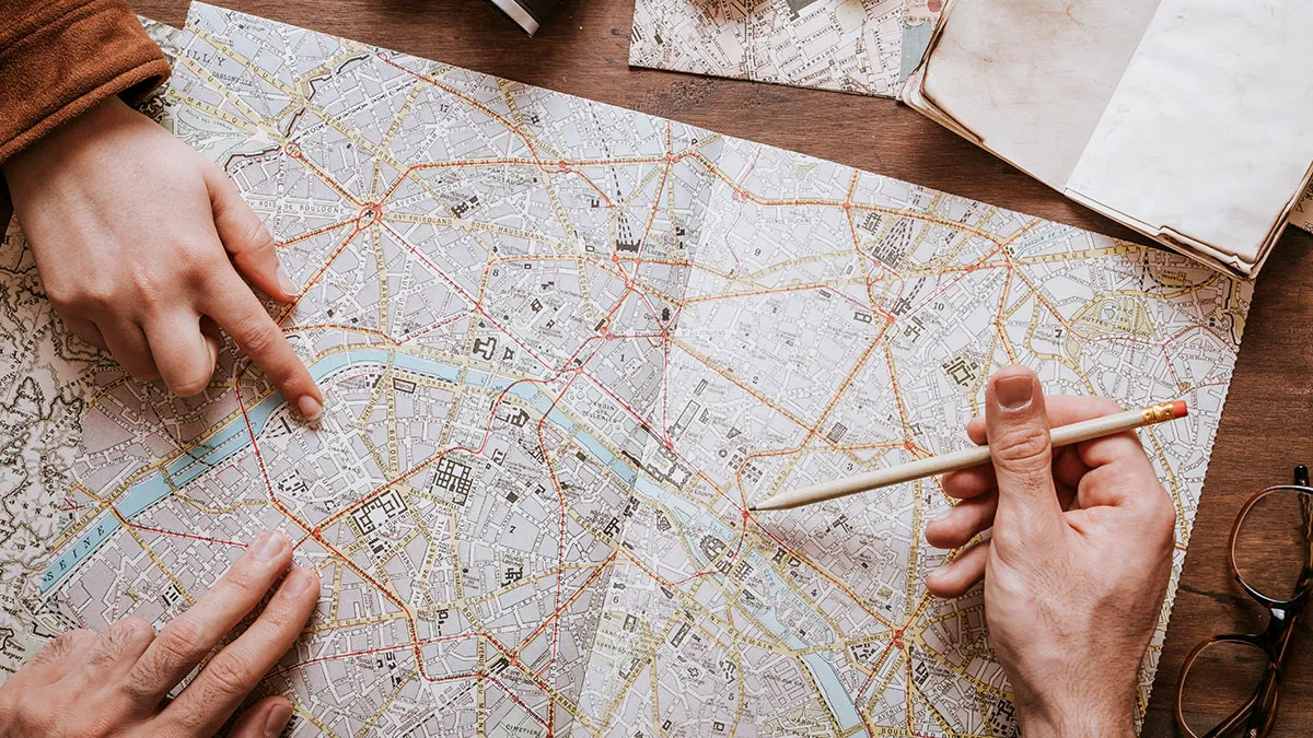
As mapmaking became more detailed, people also started using maps to show much more than physical geography. By the late 19th century, some maps could show individual buildings with remarkable detail.
Businesses quickly realized that being included could be valuable, too. According to Smithsonian, some American mapmakers even charged merchants to have their buildings featured more prominently.
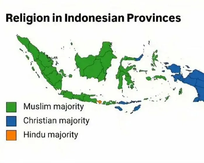
#22 What Explains The Western Part Of Indonesia Being Of An Islamic Majority While The Eastern Side Is Being Of A Christian Majority, With The Island Of Bali Being Hindu Majority?
Maps could carry much more serious messages as well. In the 1880s, social reformer Charles Booth created a map of London that color-coded areas according to income and supposed criminal behavior.
His goal was partly to draw attention to poverty, yet dividing neighborhoods in this way could also reinforce harmful ideas about the people living there. Similar thinking later appeared in American redlining, when banks refused loans to people based on where they lived.
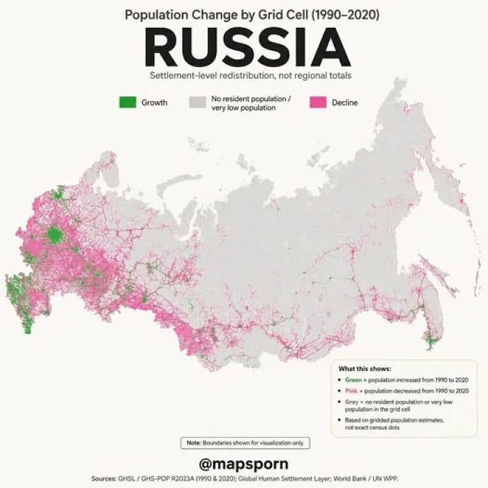
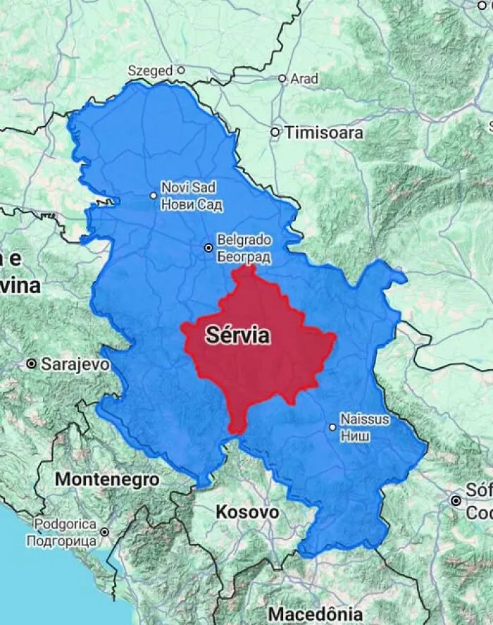
So, as fascinating as maps can be, it is still worth looking at them with a critical eye. Depending on who created a map and what information they chose to include, it can influence how we understand the world and even how we see certain countries or local communities.
In the wrong hands, that kind of influence can become surprisingly powerful. It is something worth keeping in mind the next time a map catches your attention.
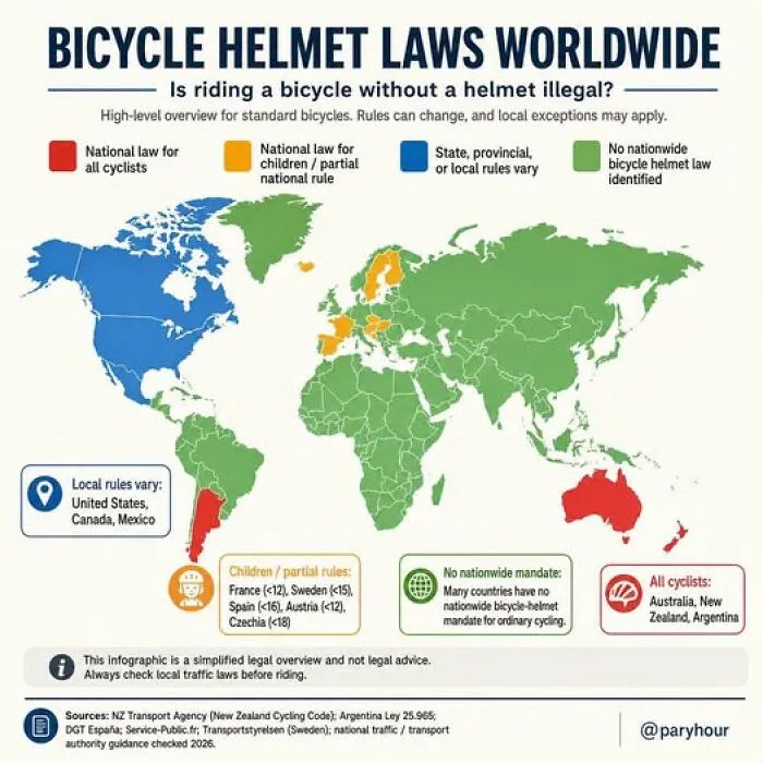
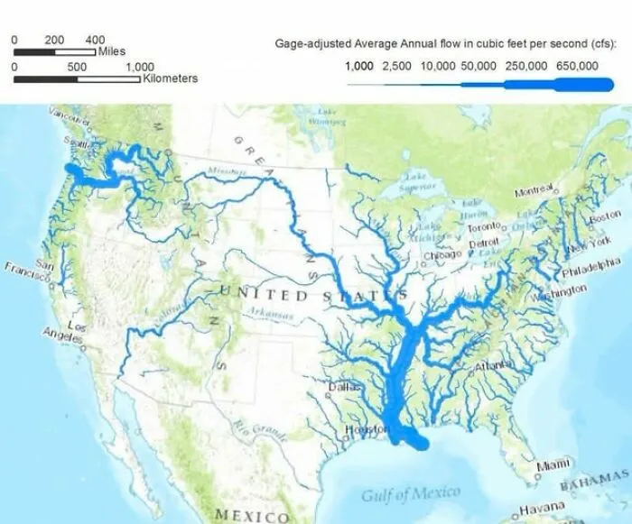
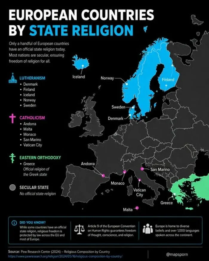
#33 Did You Know That Only A Handful Of European Countries Still Have An Official State Religion?
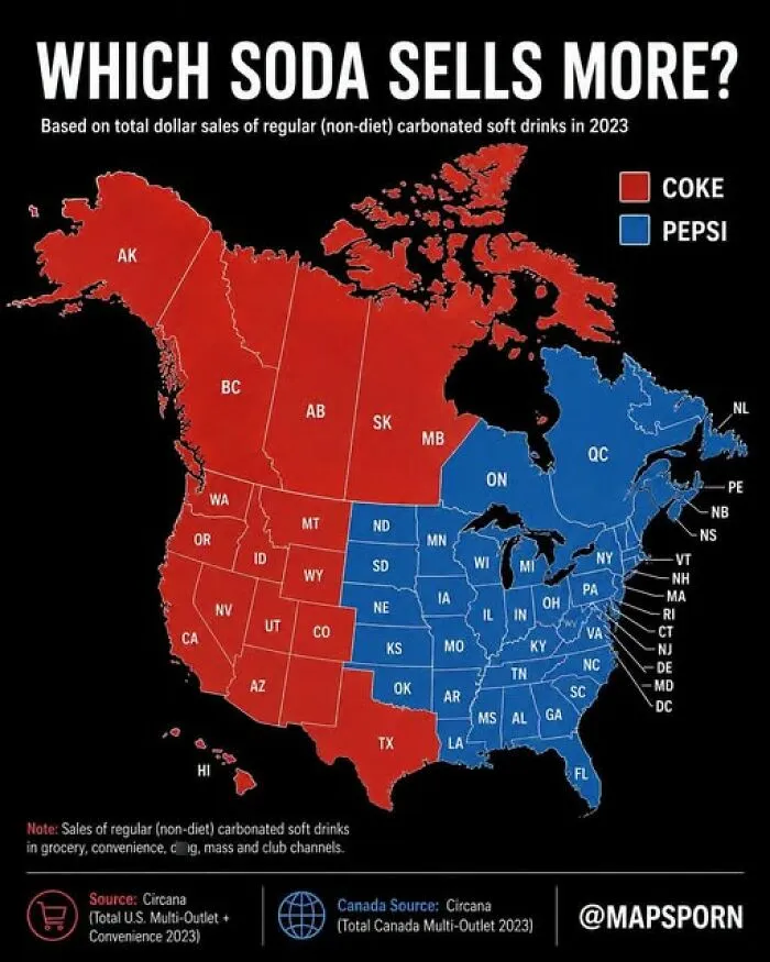
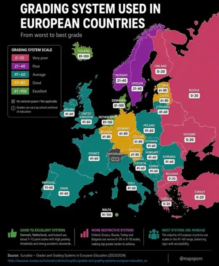
#35 Ever Wonder How A "Straight-A" Student In One Country Would Fair In Another?
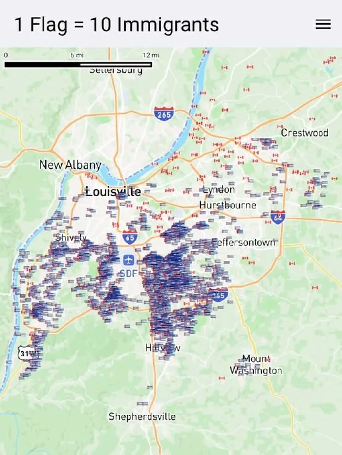
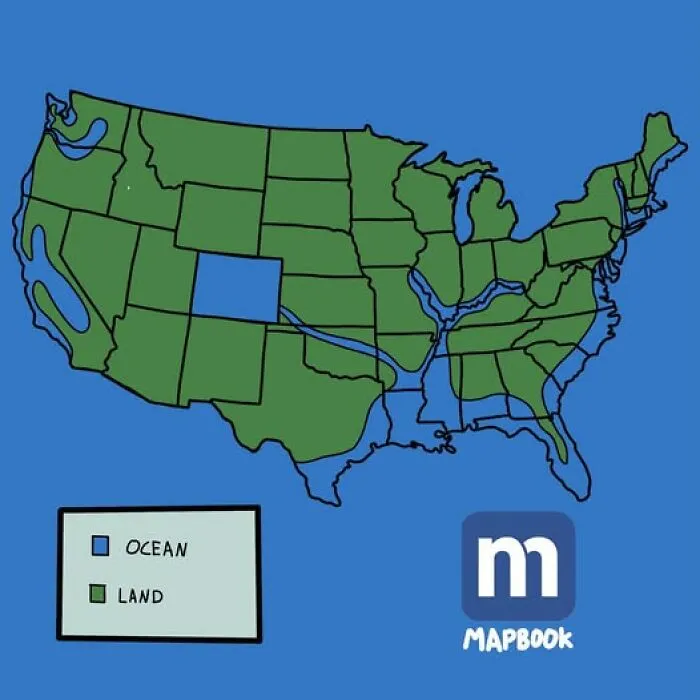
#38 North America If The Sea Level Rises Another 2 Inches From Climate Change