

Bored Panda
46 Fascinating Photos Of World Geography That Will Amaze You

46 Fascinating Photos Of World Geography That Will Amaze You

50
3
Geography shapes human life in multiple ways, from the resources we have available all the way to our diverse cultures. How we study it has evolved significantly over the years, moving from basic drawings to more sophisticated high-resolution satellite maps and interactive GIS platforms. In this collection, you’ll find 50 photos of interesting geography from around the world. The images not only highlight breathtaking landscapes and oceans, but also a variety of maps and charts. They also give us a fascinating glimpse into how we interact with the world around us and how geography influences our daily lives.
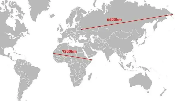
#21 Look At This Curiosity!

World geography map showing distances of 6400 km and 7200 km between various points across continents.
Report
21points

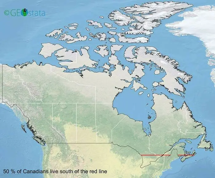
#22 50 Percent Of Canadians Live South Of The Red Line

Map of Canada showing 50 percent of the population living south of the red line illustrating fascinating world geography.
21points

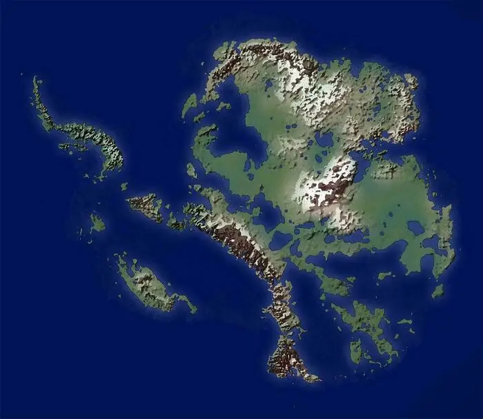
#23 How Antarctica Would Look If All The Ice Melted

A detailed satellite view of varied terrain, showcasing fascinating world geography features with mountains and islands.
Report
18points

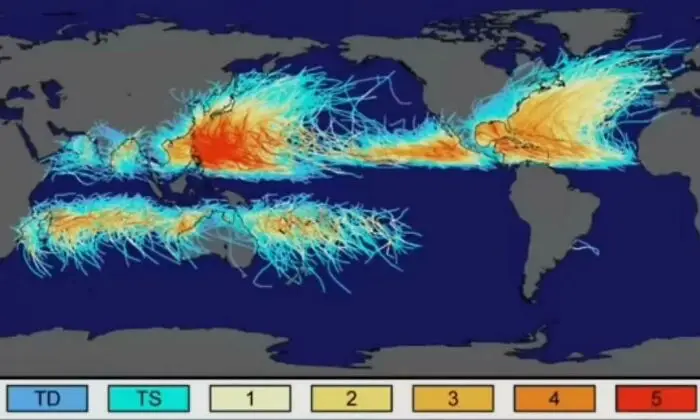
#24 No Hurricane Has Ever Crossed The Equator

Map showing hurricane paths and intensities across world geography with color-coded storm categories and impact zones.
18points

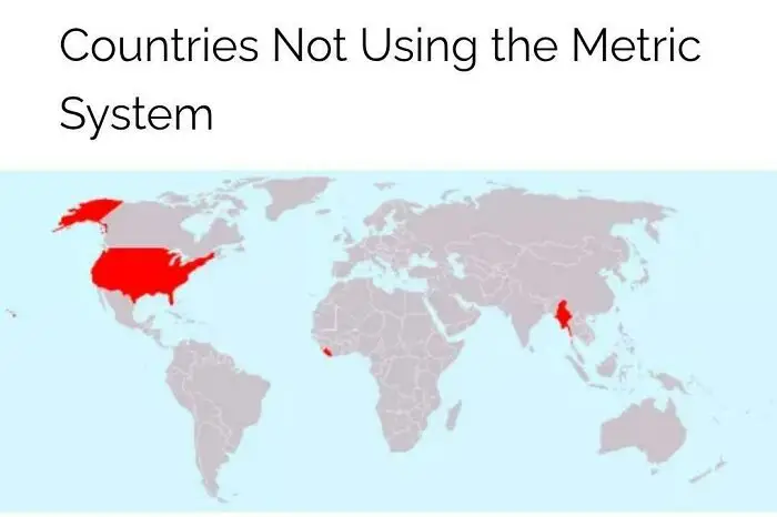
#25 Bro Why Not Use The Metric System?

World geography map highlighting countries not using the metric system in red, showing global measurement differences.
18points

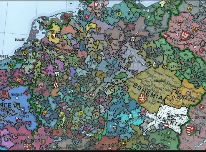
#26 Europe Used To Look Like This!

Colorful detailed map highlighting historical regions and territories in Europe, showcasing fascinating world geography features.
17points

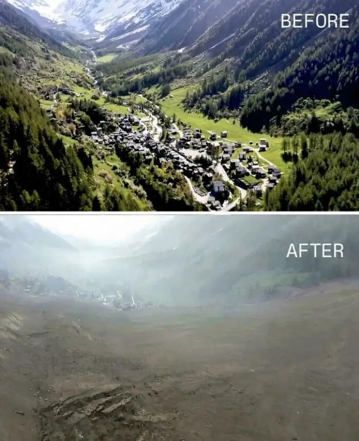
#27 Huge Landslide Causes Whole Village To Disappear In Switzerland

Aerial before and after photos showing dramatic changes in world geography with a valley transformed by natural disaster.
16points

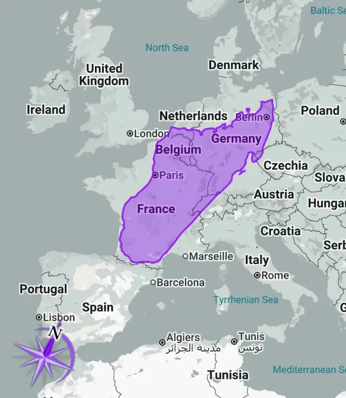
#28 Madagascar Is Way Bigger Than I Thought

Map highlighting France, Belgium, and Germany in Europe for world geography with seas and neighboring countries shown.
16points

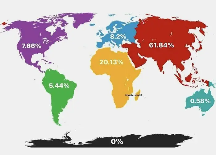
#29 Chances Of Being Born In Each Continent

World geography map showing continental percentage distribution with colorful regions highlighting population or area data.
15points

#30 Cross Sea Is A Very Beautiful And Rare Phenomenon That Happens When There Are 2 Wave Systems In The Sea Moving At Oblique Angles
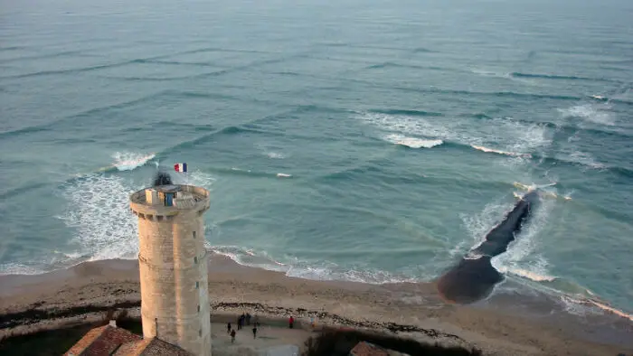
A coastal lighthouse overlooking a unique natural seawater flow, showcasing fascinating world geography features.
It might be beautiful from above, but if you get caught in these waves, your vessel can easily turn upside down or lose its way.
13points

#31 A Map Of Nations When Asked The Question "Which Country Is The Largest Threat To World Peace?" - In 2013
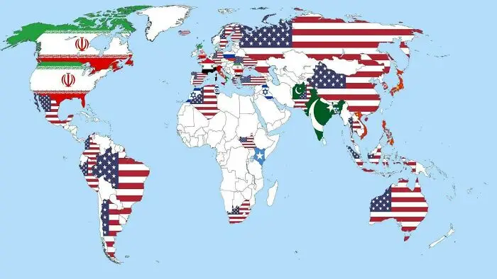
World geography map showing countries filled with different national flags, highlighting political boundaries and diversity.
13points

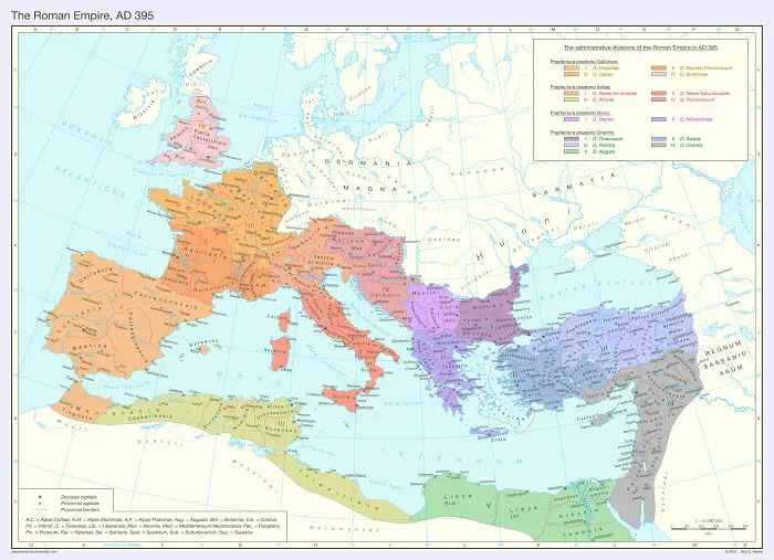
#32 The Roman Empire Administrative Divisions In 395 Ad

Map of the Roman Empire in AD 395 showing geographical divisions and regions for world geography enthusiasts.
Report
11points

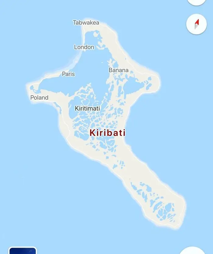
#33 I Feel As If Someone Just Got Bored Of Naming Things Here

Map of Kiribati showing Kiritimati Island and surrounding lagoons, a fascinating example of world geography.
11points

#34 Estonia Is The Northernmost Country In The World With No Part Of It Being In The Arctic
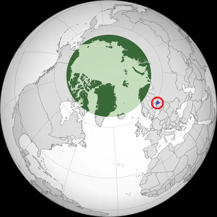
Polar projection map showing detailed world geography with a specific country highlighted in blue and red for emphasis.
10points

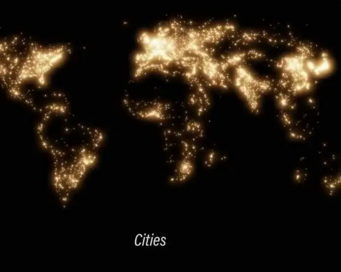
#35 All Cities In The World

Glowing city lights map showing population density across continents in a fascinating world geography representation.
10points

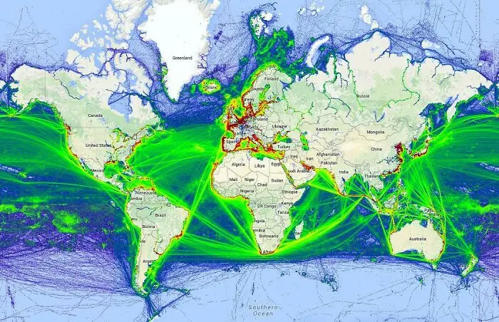
#36 The Actual Map Of Ship Traffic

World geography map showing global shipping routes with vibrant green and yellow lines highlighting busy maritime pathways.
10points

In addition to making up over 97% of the Earth’s water, oceans also cover 71% of the planet’s surface. The Pacific Ocean, which is the largest of the five major oceans, makes up 31% of the surface and averages about 13,000 feet in depth. Second in size is the Atlantic Ocean, which covers 20% of the planet’s surface. Surprisingly, only 5% of the world's oceans have been explored, with the other 95% remaining a complete mystery.
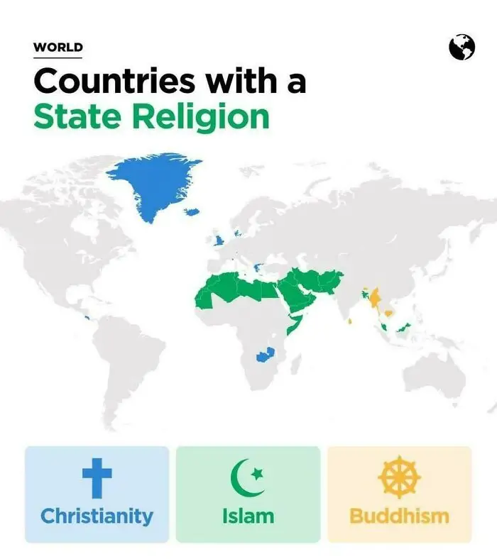
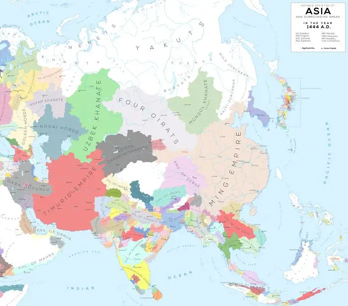
#37 Countries With State Religion

World geography map showing countries with a state religion including Christianity, Islam, and Buddhism highlighted by color.
10points

#38 Asia (And Surrounding Areas) In 1444

Colorful historical map of Asia’s geography showing various empires and khanates in the year 1444 AD.
10points

#39 Every Territory England, Great Britain, And The UK Ever Controlled
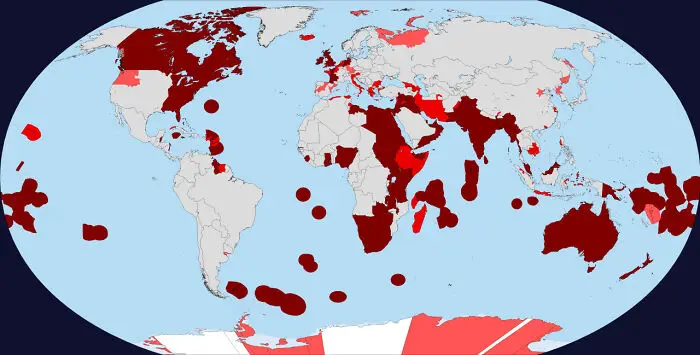
World geography map highlighting countries and territories in various shades of red showing global distribution and locations.
10points

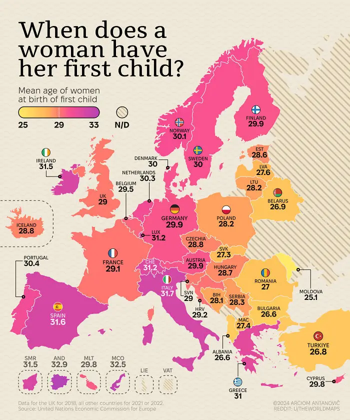
#40 Mean Age Of Women At Birth Of First Child

Map showing mean age of women at birth of first child across Europe, a fascinating world geography photo highlighting age variations.
10points
50
3