
Bored Panda
20 Historic Canals That Changed World Trade And Engineering, According To This Expert

20 Historic Canals That Changed World Trade And Engineering, According To This Expert

34
2
In March 2021, a single container ship turned sideways in the Suez Canal and brought one of the world’s busiest shipping lanes to a standstill. For six days, the Ever Given held up hundreds of vessels and left businesses around the globe waiting for their goods. It was a sharp reminder of how much modern commerce still depends on a few narrow passages.
Yet the idea of reshaping waterways for transport is far older than container ships and digital tracking. Long before railways and highways, canals carried food, fuel, building materials, and ideas across continents. Building them meant diverting rivers, cutting through hills, and managing changing levels. Some projects proved brilliant, while others ran up against cost, geography, politics, or the never-ending work of maintenance.
To explore how these waterways shaped trade and everyday life, Bored Panda once again spoke with Ali Mujtuba Zaidi, a researcher at The Historical Insights. Drawing on historical sources and his research into the history of engineering, Mujtuba selected 20 canals, structures, and related sites, not all of them canals in the strict sense. Each one offers insight into how it functioned, why it mattered, and what it reveals about humanity’s long effort to make water work for us.

#1 Neptune’s Staircase
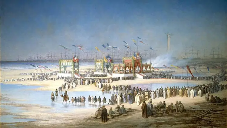
Historic canal locks lined up sequentially for waterway engineering and trade.
Modern Equivalent: militarized maritime chokepoint bypasses.
Neptune’s Staircase, near Banavie in Scotland, is a flight of eight locks on the Caledonian Canal. The canal was built in the early nineteenth century and created a route through the Great Glen, reducing the need for ships to travel around the exposed northern coast of Scotland. The locks raise or lower vessels in stages rather than attempting one enormous change in level.
The Caledonian Canal had strategic as well as commercial aims, though it did not become the major commercial route its supporters had hoped for. Its scale is still striking. The interesting trade-off is that a canal can shorten a journey on a map while requiring a lot of water, maintenance, and time to operate.
Date: 1803 to 1822
Culture: British Empire
Location: Great Glen Fault
Primary evidence: Monumental Ashlar Chambers
12points

One problem comes up again and again in this list: how do you move a boat when a waterway rises or falls? The earliest answer was the flash lock, a simple gate that sent vessels through on a sudden surge but wasted supply and created tricky currents. The pound lock changed that by raising or lowering boats inside a closed chamber, while flights of locks tackled steeper climbs one step at a time. In a few places, engineers turned to boat lifts, mechanical giants that carry vessels up and down in water-filled tanks.

Mujtuba points out that these methods didn’t replace one another in a tidy, worldwide progression. Each region chose what suited its terrain, budget, local materials and traffic. “Engineers were not following one inevitable path,” he says. “They were trying to solve local problems with the tools and resources they had.”

#2 The Modern Suez Canal
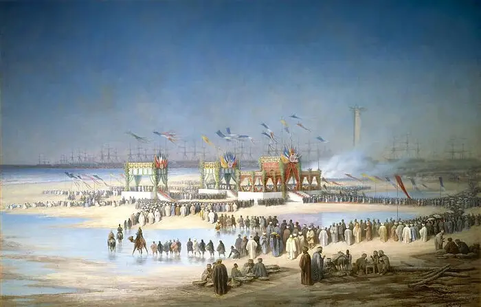
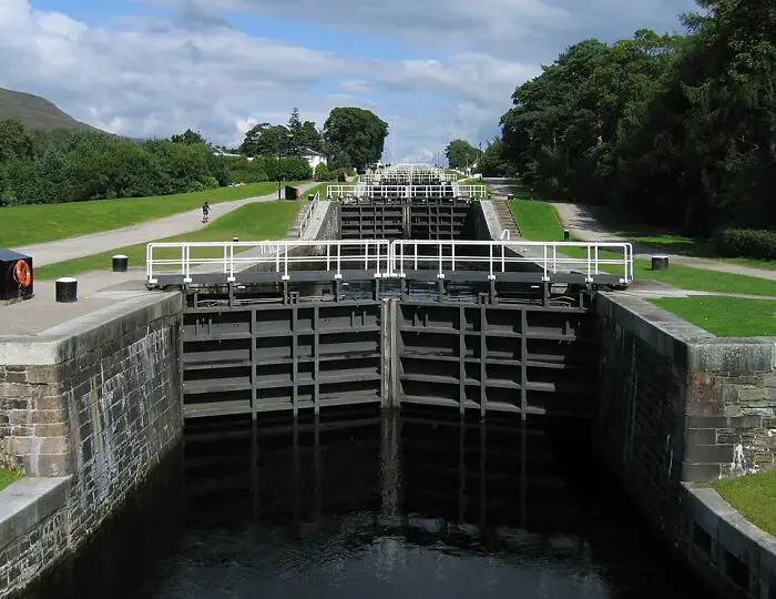
Painting depicting the inauguration ceremony of the Suez Canal, a historic canal that changed world trade
Modern Equivalent: the opening of trans-oceanic fiber optic cables.
The modern Suez Canal opened in 1869 and created a direct sea route between the Mediterranean and the Red Sea. Unlike a canal that climbs over a ridge, it was designed as a sea-level passage and does not use locks. It shortened the sea journey between Europe and parts of Asia by avoiding the long trip around the Cape of Good Hope.
The project also had a human and political cost. Egyptian labourers were compelled to work during early phases of construction, and later work relied increasingly on mechanised dredging. It is important to hold both facts together: the canal was a major engineering achievement, but its construction was shaped by unequal power as well as technical ambition.
Date: November 1869
Culture: French/Egyptian Imperial
Location: Isthmus of Suez
Primary evidence: Ceremonial Documentary Painting
11points

#3 The Ever Given And A Global Bottleneck
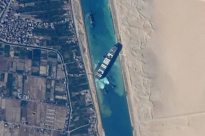
Aerial satellite view of a container ship wedged in the Suez Canal, a key historic canal for world trade
Modern Equivalent: a single server failure causing a global network outage.
When the container ship Ever Given became lodged in the Suez Canal in March 2021, traffic through one of the world’s most important shipping routes was interrupted for nearly a week. The incident showed how a narrow passage can become a bottleneck for a global system that depends on ships arriving on schedule.
Wind, vessel handling, and the interaction between a large ship and the canal’s banks were all relevant to the incident. Hydrodynamic effects can matter in confined channels, but it would be too simple to blame the grounding on bank suction alone. The modern shipping may be technologically advanced, yet it still depends on geography, careful navigation, and contingency planning.
Date: March 2021
Culture: Globalized Commerce
Location: Southern Canal Reach
Primary evidence: Astronaut Photography
10points

That practical spirit is still visible today. Some of these waterways continue to carry freight, while others survive mainly as heritage sites, yet both show how societies once linked farms with cities, mines with factories and inland regions with the sea. Ships, navigation and ports have changed beyond recognition, but the core challenges haven’t: water must be controlled, routes have to stay open, and one blockage in the wrong place can ripple far beyond the canal itself. 

Which of these engineering feats impresses you most, and is there a waterway you think deserves a spot on this list? Let us in the comments!

#4 The Pontcysyllte Aqueduct
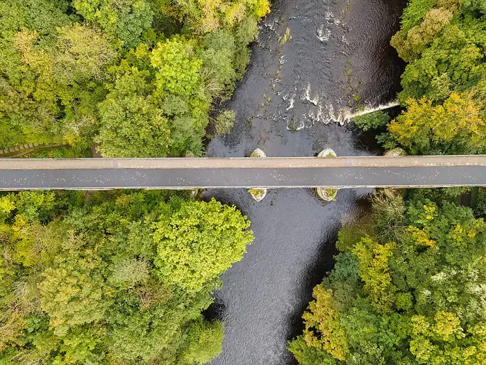
Top-down view of an aqueduct built over a river, showcasing canal engineering.
Modern Equivalent: long-span continuous steel girder bridges.
The Pontcysyllte Aqueduct in Wales carries the Llangollen Canal high above the River Dee valley. Designed by Thomas Telford with the involvement of William Jessop, it opened in 1805 and became a landmark of industrial-era engineering. Its iron trough and tall masonry piers made it possible to carry a canal across a valley without building a massive solid structure across the whole gap.
The joints of the trough were carefully sealed, and the use of iron was central to the design. The aqueduct is not simply an example of iron replacing stone; it shows how different materials could be combined to solve different structural problems. Its elegance comes from that combination of strength, economy, and a very clear purpose.
Date: 1805
Culture: British Industrial Revolution
Location: River Dee Valley
Primary evidence: Cast-Iron Flanged Plates
7points

#5 The Erie Canal At Lockport

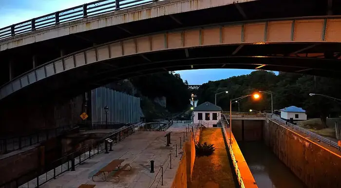
View of canal locks illuminated at night under a large bridge, showcasing historic canal engineering
Modern Equivalent: continental transcontinental rail grades.
The Erie Canal connected the Hudson River at Albany with Lake Erie, helping link the Great Lakes region to New York City and Atlantic markets. At Lockport, the Niagara Escarpment presented a major change in elevation. A series of locks made it possible for boats to climb the escarpment and continue along the canal.
That route helped move agricultural goods and people across New York State and contributed to the growth of New York City as a commercial centre. It was one factor among several, not the sole cause of the city’s rise. The canal’s significance is easiest to understand as a change in access: places that had been expensive or slow to reach became more closely connected to larger markets.
Date: 1817 to 1825
Culture: Early American Republic
Location: Niagara Escarpment
Primary evidence: Parallel Double Staircase Locks
7points

#6 Baodai Bridge And Waterway Management
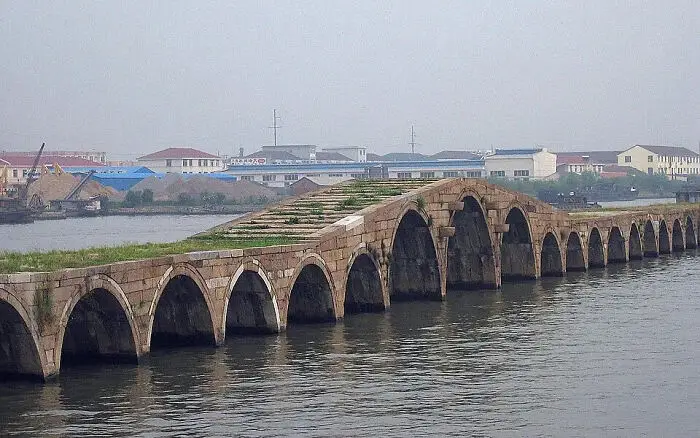
An ancient arched stone bridge spanning a wide waterway, showcasing historic canal engineering.
Modern Equivalent: multi-span concrete causeways stabilizing wetland crossings.
The Baodai Bridge near Suzhou is associated with the waterway landscape of China’s Grand Canal region. Bridges, embankments, and channels often had to do several jobs at once: let people cross, allow boats to pass, and manage the movement of water. The bridge is a reminder that canal infrastructure was never just the channel itself.
Probably it’s best not to see the bridge as a simple canal aqueduct, or to assume we know every detail of its original purpose. What impresses the most is how water transport shaped the landscape around it. A working canal needed routes for boats, paths for people and animals, and structures that could cope with changing water levels.
Date: 816 CE (Tang Dynasty)
Culture: Imperial China
Location: Grand Canal
Primary evidence: Baodai Stone Arch Bridge
6points

#7 The Shaduf: Lifting Water By Hand

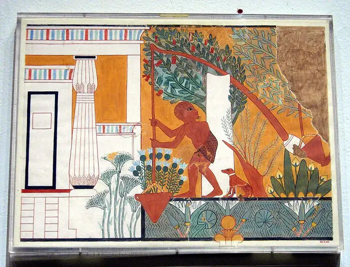
Ancient Egyptian artwork showcasing early irrigation engineering near a water source.
Modern Equivalent: mechanized irrigation pumping stations.
The shaduf was a simple counterweighted lever used to lift water from a river or canal into fields. It was not a canal itself, but it helps explain one of the everyday problems behind early irrigation: getting water from a lower level to a higher one. It is worth including because big infrastructure often depended on small tools and repeated human effort.
The tomb of Ipuy at Deir el-Medina includes a well-known scene associated with water lifting. The image is evidence for the tools and work practices represented in the tomb, rather than proof of a single, universal irrigation system. Early canals often relied on gravity, so water could only flow where the ground and channel allowed it to go. Lifting water uphill required extra work or equipment.
Date: c. 1290 BCE
Culture: New Kingdom Egypt
Location: Deir el-Medina
Primary evidence: Tomb TT217 Painting
5points

#8 Canals And Farming Around Memphis

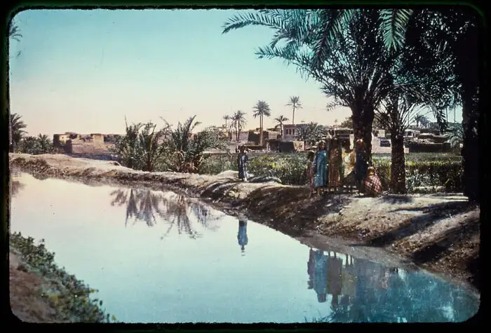
Landscape view of a quiet historic canal lined with palm trees and reflection in rural Egypt.
Modern Equivalent: agricultural diversion aqueducts requiring constant dredging.
The Nile floodplain depended on seasonal water, and people built and maintained channels to guide that water toward fields and settlements. Around Memphis, waterways formed part of a much wider landscape of farming, transport, and administration. The exact layout of ancient channels changed over time, and it is difficult to reconstruct every branch from surviving evidence.
Channels cut through soft alluvial ground could fill with silt or suffer damage to their banks. Keeping them useful required regular maintenance. It's better to be careful about claiming that all ancient trade stopped outside a particular season, but seasonal flooding and upkeep clearly shaped what people could grow, move, and store.
Date: Old Kingdom onwards
Culture: Ancient Egyptian
Location: Lower Nile Floodplain
Primary evidence: Hydraulic Landscape Preservation
5points

#9 Small Boats On Local Waterways

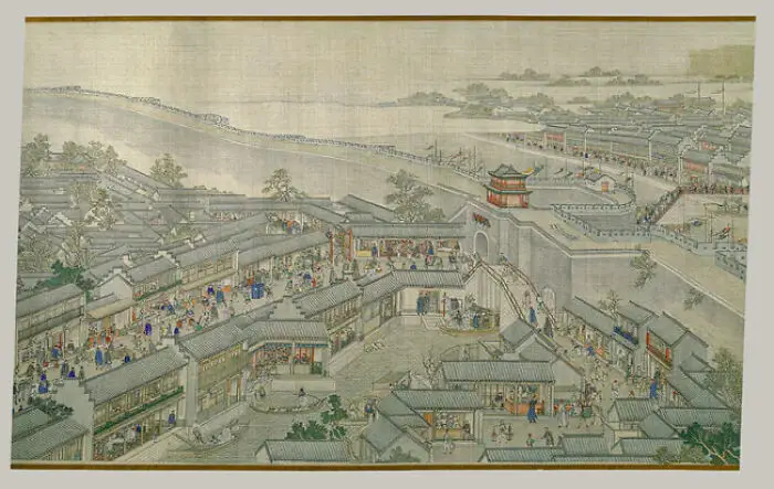
Ancient traditional painting depicting a bustling city alongside a historic canal.
Modern Equivalent: small municipal delivery box trucks feeding main highways.
Smaller wooden boats were essential to many inland waterway networks. Shallow-draft craft could reach places that larger cargo boats could not, and they were often moved by poles, oars, or other locally adapted methods. A term such as yuloh refers to a type of sculling oar used in parts of East Asia, though boat designs varied widely across the region.
The broader point is simple: large canals depended on smaller routes and vessels to move goods the final distance. It's an important detail because it keeps the story from becoming only about monumental structures. Trade also relied on ordinary boats, skilled crews, and local knowledge.
Date: Traditional Design
Location: Lower Yangtze Branches
Primary evidence: Yuloh Sculling Craft
5points

#10 Suzhou’s Canal-Centred City

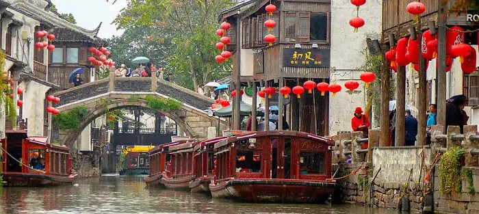
Traditional wooden boats moored along a historic canal in a picturesque Chinese water town under red lanterns.
Modern Equivalent: inner-city logistics hubs and final-mile distribution grids.
Suzhou grew around a network of canals and streets, with water routes woven into the daily life of the city. The historic Pingjiang map, dated to the thirteenth century, is an important record of this relationship between urban space and waterways. Canals could carry goods, provide access to workshops and homes, and support local movement.
That does not mean every canal served as a formal freight terminal or drainage channel in the modern sense. Uses varied by place and period. And yet, Suzhou is a strong example of how a waterway can shape a city’s layout rather than simply pass through it.
Date: Song to Qing Dynasties
Culture: Imperial China
Location: Yangtze River Delta
Primary evidence: Pingjiang Map (1229 CE)
4points

#11 China’s Grand Canal Today

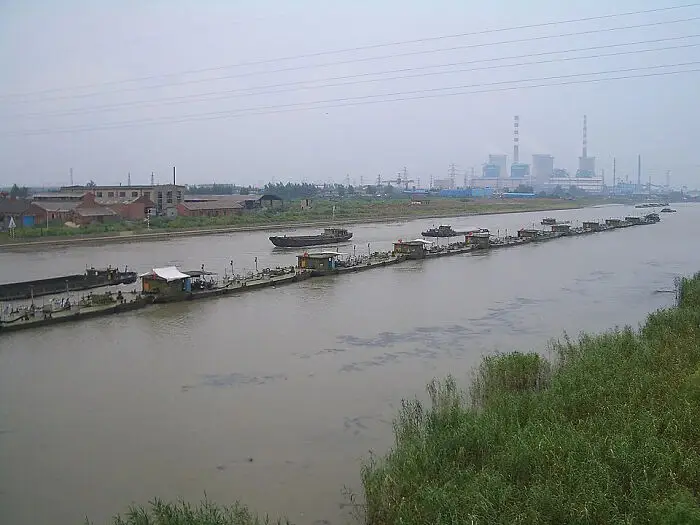
Long line of cargo barges navigating a modern stretch of a historic canal.
Modern Equivalent: high-volume diesel rail freight networks.
China’s Grand Canal is not just an archaeological remnant. Parts of the enormous system remain in use, including sections that carry freight. Modern navigation depends on dredging, maintenance, water management, and upgrades, so the canal people see today is both a historic route and a modern transport system.
The canal’s condition and traffic vary along its length, so it would be misleading to describe every section as equally busy or equally suitable for large vessels. Its continued use is what makes it especially interesting: an infrastructure project can survive for centuries when people keep adapting it to new needs.
Date: Sui Dynasty (Origins) / Present Day
Culture: Modern China
Location: Grand Canal (Southern Reach)
Primary evidence: Class III Navigation Upgrades
4points

#12 Keeping The Canal Du Midi Supplied
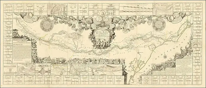
An intricate historic map detailing early engineering and route plans for canals.
Modern Equivalent: municipal mega-reservoirs powering regional aqueducts.
The Canal du Midi, built in the seventeenth century under the direction of Pierre-Paul Riquet, linked the Atlantic-facing Garonne system with the Mediterranean. One major challenge was supplying water to the canal’s highest sections. A summit canal cannot depend on water simply flowing over the crest from a river, so it needs a reliable supply from reservoirs and feeder channels.
Riquet’s system collected water from streams in the Montagne Noire and stored it in reservoirs, including the Saint-Ferréol reservoir. UNESCO describes the Canal du Midi as a major achievement in civil engineering. The clever part was not just digging a route across the landscape; it was planning how to keep that route supplied with water.
Date: 1667 to 1681
Culture: Early Modern France
Location: Montagne Noire Divide
Primary evidence: Bassin de Saint-Ferréol
4points

#13 The Malpas Tunnel

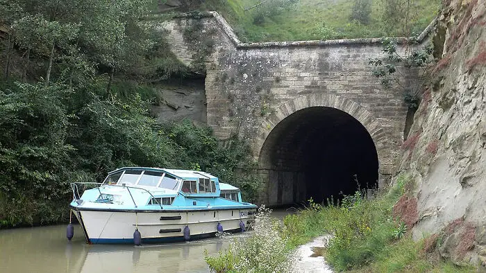
A small blue boat exiting a stone tunnel along a historic canal waterway.
Modern Equivalent: mountain highway and rail tunnel boring.
The Malpas Tunnel on the Canal du Midi was completed in 1679–1680 and is widely recognised as an early navigable canal tunnel. Rather than taking the canal over the hill, the builders carried it through the ridge. The project faced geological and political difficulties, and its construction is often associated with Riquet’s determination to continue despite opposition.
It's important to be cautious about repeating the dramatic claim that the tunnel was blasted through in only eight days; the work was more complex than that. Even so, the tunnel mattered. It showed that a canal could pass beneath a hill instead of being forced to follow every contour of the land.
Date: 1679 to 1680
Culture: Early Modern France
Location: Ensérune Ridge
Primary evidence: Vaulted Tunnel Architecture
4points

#14 The Bridgewater Canal And Manchester
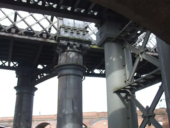
Underneath a large metal bridge structure reflecting historic engineering feats.
Modern Equivalent: intermodal freight railheads and container yards.
The Bridgewater Canal, opened in 1761, helped bring coal from the Duke of Bridgewater’s mines to Manchester and made water transport a central part of the region’s industrial growth. The canal was associated with engineer James Brindley and became a model for later canal projects. Cheaper, more reliable coal transport helped industry, although the often-repeated claim that prices were cut by exactly half depends on the source and context.
Manchester’s Castlefield area preserves traces of this transport history, including canal basins, warehouses, and later railway structures. The most revealing thing is how one transport system often builds on another. Canals did not simply disappear when railways arrived; they helped shape the industrial towns and freight routes that railways later served.
Date: 1761 to 1764
Culture: British Industrial Revolution
Location: Bridgewater Canal
Primary evidence: Potato Wharf Stone Quays
4points

#15 The Worcester Bar Dispute

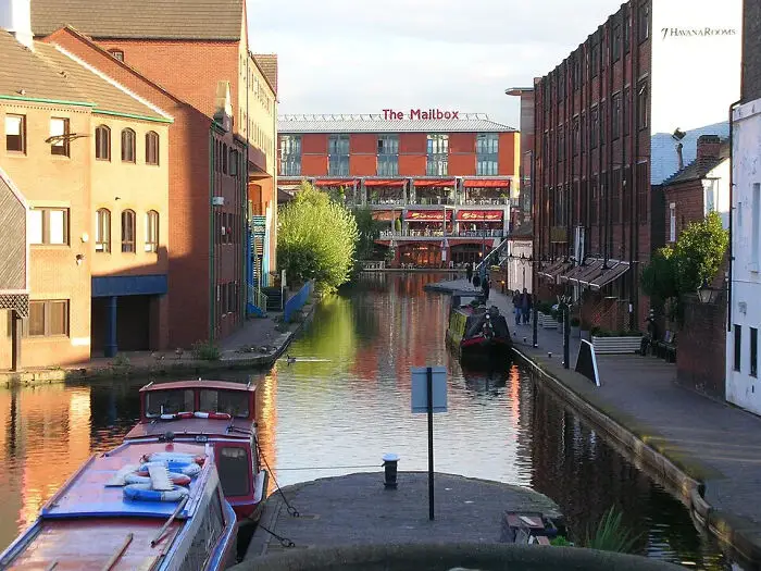
Urban canal lined with brick buildings and boats, representing historic canals.
Modern Equivalent: incompatible rail gauges requiring manual cargo transfers.
Gas Street Basin in Birmingham sits where important canal routes meet. In the early canal era, companies sometimes built lines that did not connect smoothly with neighbouring waterways. The Worcester Bar became a well-known obstacle between the Birmingham Canal and the Worcester and Birmingham Canal, forcing goods to be transferred until an agreement allowed the routes to connect.
The episode is a useful reminder that engineering alone does not guarantee a good transport network. Companies also had to agree on access, water supply, and fees. This is one of the clearest historical examples of a problem that still affects infrastructure: a system works best when its separate parts can work together.
Date: 1769 to 1815
Culture: British Industrial Revolution
Location: Birmingham Canal Navigations
Primary evidence: The Worcester Bar Stop Lock
4points

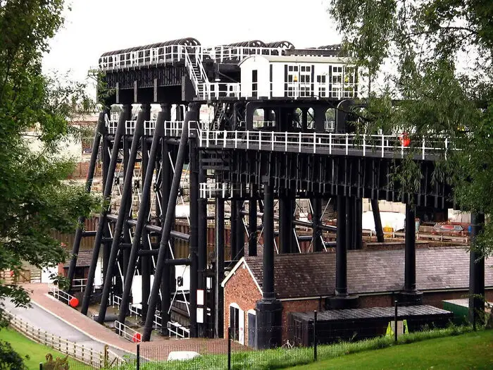
#16 The Anderton Boat Lift

Massive black industrial boat lift structure, an impressive feature of historic canal engineering
Modern Equivalent: high-speed automated container gantry cranes.
The Anderton Boat Lift opened in 1875 to move boats between the Trent and Mersey Canal and the River Weaver, about 15 metres apart vertically. It replaced a slower and more awkward transfer between the two waterways. Its paired water-filled caissons were designed to balance one another, reducing the force needed to move them.
The lift’s mechanism changed over time, and the original hydraulic system was later replaced by an electrically powered arrangement before a major restoration. So it is not quite right to describe the whole system as a simple, nearly power-free exchange. The impressive part is the idea itself: instead of making boats pass through a long flight of locks, engineers built a machine to move them between levels.
Date: 1875
Culture: Victorian Industrial
Location: River Weaver Navigation
Primary evidence: Counterbalanced Wrought-Iron Rams
3points

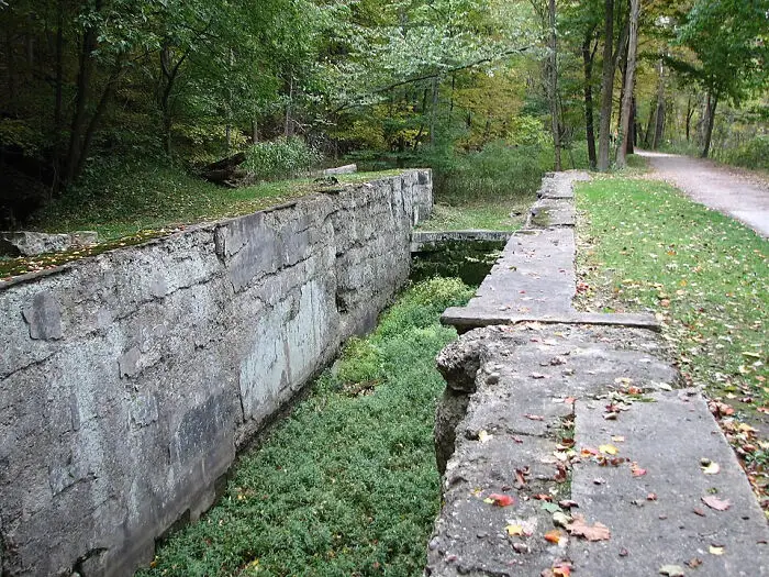
#17 The Ohio And Erie Canal

Old concrete ruins of a lock system along a historic canal, showcasing early engineering feats
Modern Equivalent: rural highway off-ramps stimulating regional agricultural hubs.
The Ohio and Erie Canal connected Lake Erie with the Ohio River system and helped open a more direct route between inland Ohio and eastern markets. Locks, feeders, and reservoirs were needed to keep the route usable across changing terrain and seasons. The remains of individual locks can tell us about local materials and construction methods, but one lock alone cannot represent the whole canal.
The canal helped move agricultural produce and other goods, supporting settlement and commerce along its route. Claims that journeys were reduced from months to days can depend on the starting point and mode of transport, so it's better to not treat one figure as universal. The broader change is clear: canals lowered some transport costs and made market connections more practical.
Date: 1825 to 1832
Culture: Early American Republic
Location: Cuyahoga River Gorge
Primary evidence: Berea Sandstone Masonry
2points

#18 The Ancient Canal Linking Nile And Red Sea
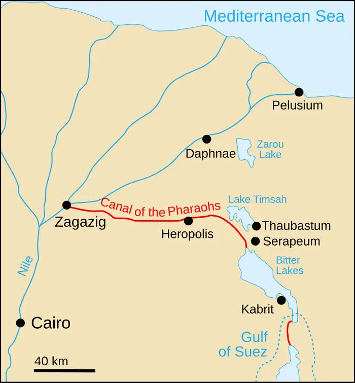
Map of Egypt highlighting the route of the Canal of the Pharaohs connecting the Nile to the Red Sea.
Modern Equivalent: the modern Suez Canal sea-level route.
The ancient canal linking the Nile region with the Red Sea is often called the Canal of the Pharaohs. Ancient accounts associate earlier attempts with Necho II, while inscriptions from the reign of the Persian king Darius I provide important evidence for a later phase of the project. The route passed through the Wadi Tumilat and connected the Nile system with the Red Sea, although its course and periods of use changed over time.
This project is fascinating because it shows that the idea of connecting maritime worlds across Egypt is far older than the modern Suez Canal. Some ancient sources describe later works to control the canal and its water. The details are debated, so it is safer not to present the use of a modern-style lock as settled fact.
Date: c. 510 BCE
Culture: Achaemenid Persian
Location: Wadi Tumilat
Primary evidence: Darius I Granite Stelae
1point

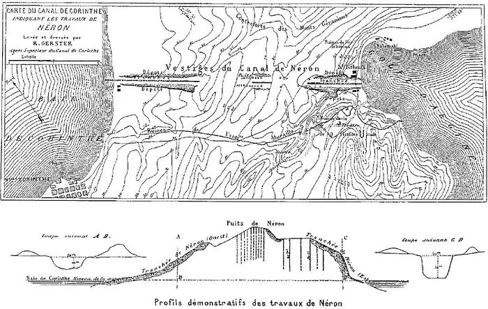
#19 Nero’s Unfinished Corinth Canal

Historical engineering map and cross-section diagram of the Corinth Canal construction works.
Modern Equivalent: deep rock mechanical trenching and explosive blasting.
In 67 CE, the Roman emperor Nero began an attempt to cut a canal across the Isthmus of Corinth. The project was abandoned after his death, and a navigable canal was not completed there until the nineteenth century. The narrow isthmus made the idea attractive: ships could avoid the long and sometimes dangerous route around the Peloponnese.
Ancient remains and later surveys help researchers study the Roman attempt, but claims about the exact route and precision of its excavations should be treated carefully. Without modern machinery, moving huge quantities of rock would have been difficult and expensive. The story is less about a failed genius project and more about the limits that labour, geology, money, and political change placed on engineering.
Date: 67 CE
Culture: Roman Empire
Location: Corinth
Primary evidence: 1881 Archaeological Survey
1point

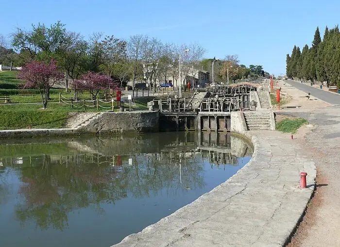
#20 The Fonseranes Locks

A stone lock mechanism along a historic canal with surrounding trees and water.
Modern Equivalent: heavy concrete retaining walls using structural geometry against earth pressure.
The Fonseranes locks near Béziers form a famous sequence on the Canal du Midi. The changing ground level made it necessary to raise or lower boats through a series of lock chambers. Some of the chambers have distinctive curved or oval forms, reflecting the design choices made by the canal’s builders.
Curved masonry can help distribute forces, but it would be too strong to say that one shape alone prevented collapse or transformed all later lock construction. The site is impressive for a more straightforward reason: it shows how engineers combined a series of manageable steps to overcome a large change in elevation. That is often how practical engineering works.
Date: 1676 to 1680
Culture: Early Modern France
Location: River Orb Valley
primary evidence: Ovoid Masonry Chambers
1point
34
2