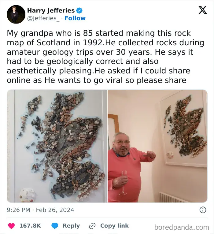
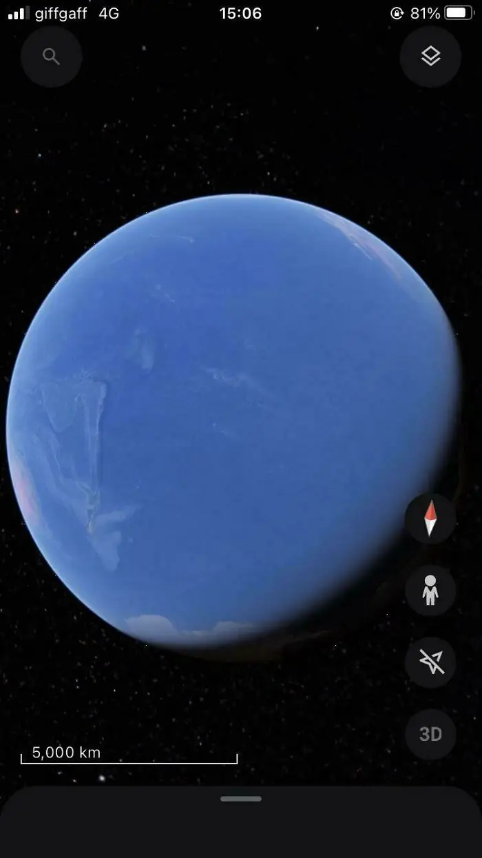
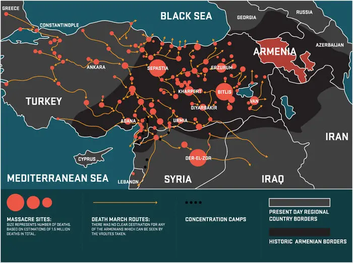
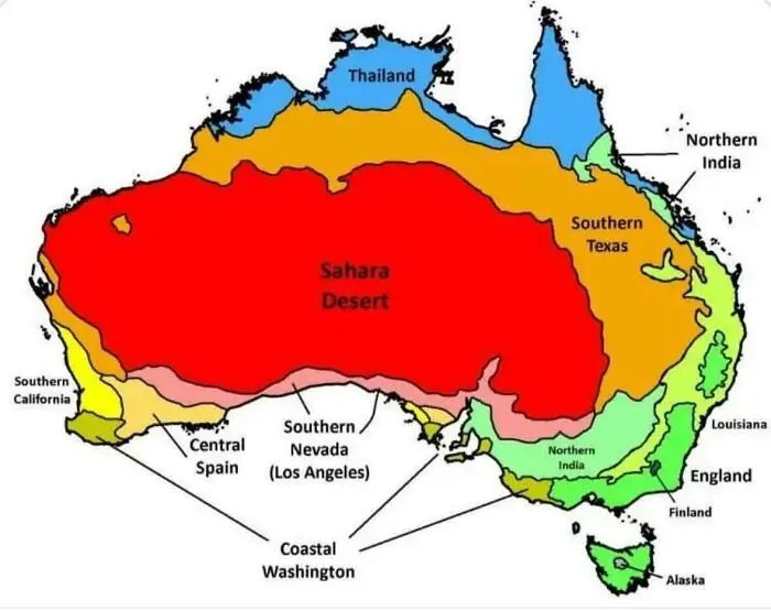
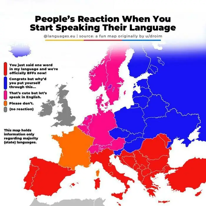
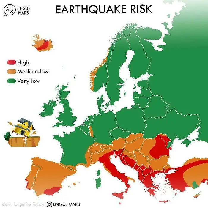
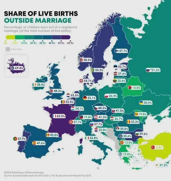
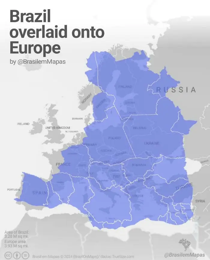
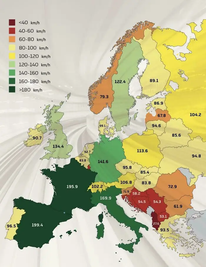
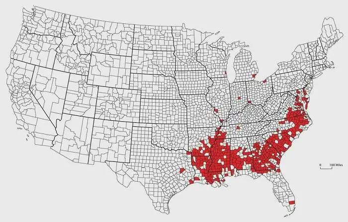
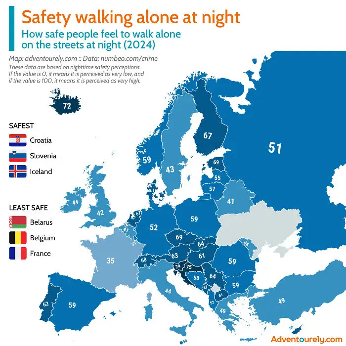
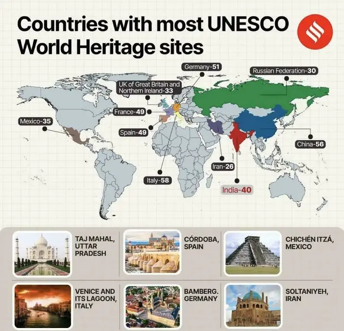
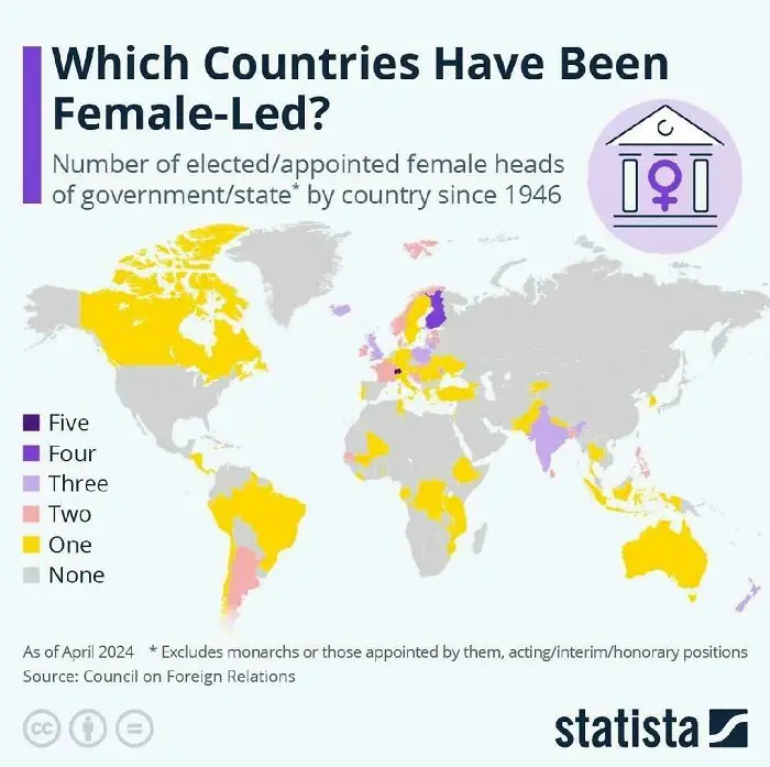
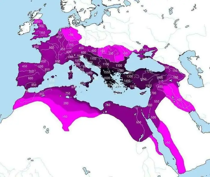
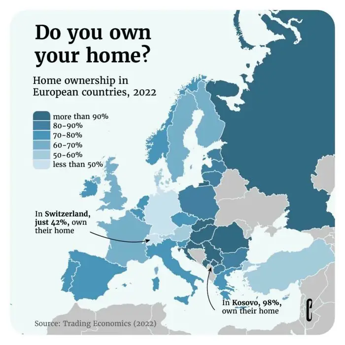
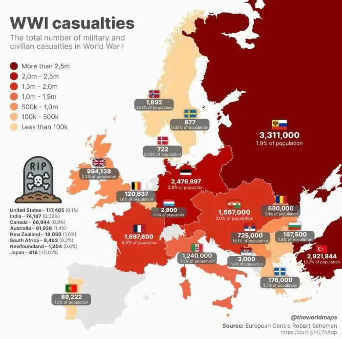
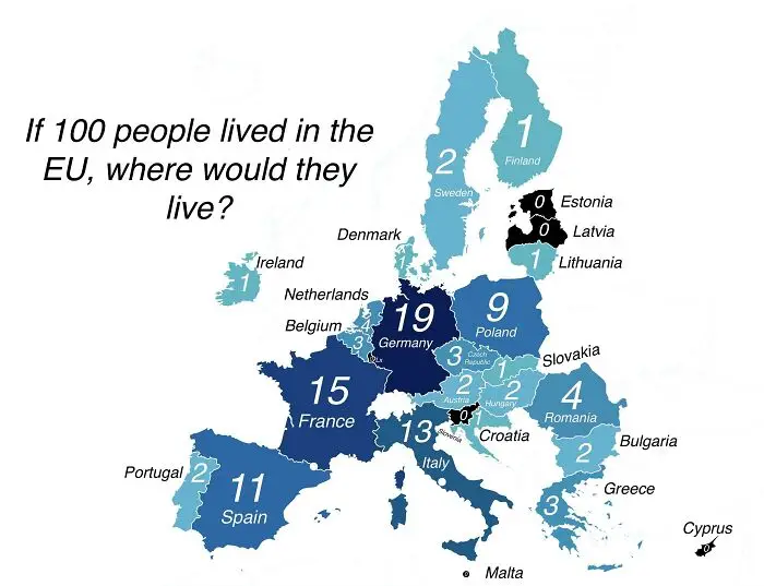
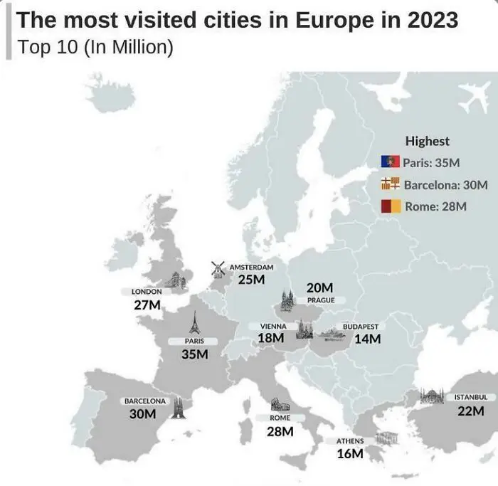
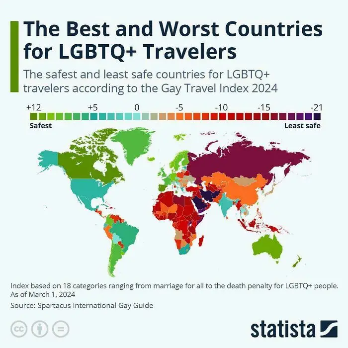
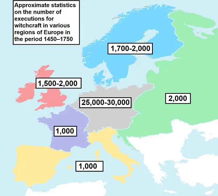
CuriositiesFEB 11, 202630 Fascinating Maps You Don't See In School, As Shared On This Online GroupEdvinas JovaišasAuthorPrefer us in SearchFollow on Discover00ShareAdd ImageArticle created by: Dominyka#1 Authentic Geological Map Of ScotlandJefferies_Report0points#2 Friendly Reminder Of How Ridiculously Big The Pacific Ocean IsThin-Pool-8025Report0points#3 Map Of Armenian Genocide And Deportation From The Ottoman Empire. It Started 109 Years Ago TodayWheatBerryPieReport0points#4 Climate Of Australia Compared To The Worldellatino230Report0points#5 People’s Common Reaction When You Start Speaking Their LanguagelanguageseuReport0points#6 Earthquake Risk In EuropeIntelligent_Store0Report0points#7 Percentage Of Children Born Out Of A Registered Marriageorange_caterp319Report0points#8 Brazil Overlaid Onto EuropeMaconheiroSafadaoReport0points#9 Average Speed Of Trains In EuropeIndividual-Sun-9426Report0points#10 U.S. Counties Where The African American Population Is 25% Or MoreVisibleSalt3Report0points#11 How Safe Do People Feel To Walk Alone At Night In Europe (2024)dazedeuReport0points#12 Countries With Most Unesco World Heritage Sites 🏰Kebida96Report0points#13 Which Countries Have Been Female LED?heynishantReport0points#14 How Many Years An Area Has Been Rules By The Roman Empiresentenza63Report0points#15 Home Ownership In European Countries (2022)Individual-Sun-9426Report0pointsNever miss a story that brings joy to the world.Add us on Google#16 First World War Casualties MappedFevercrumb1649Report0points#17 If 100 People Lived In The Eu, Where Would They Live?Mister_BarmanReport0points#18 Crazy To Think How Popular European Cities AreAcrobatic-River-5596Report0points#19 Gay Travel Index 2024No_Discussion6913Report0points#20 Witch Hunt VictimsYellowapple1000Report0pointsNext PageAdd New ImageAdd Your Photo To This ListPlease use high-res photos without watermarksUpload PhotoNot your original work? Add sourcePublish00ShareEdvinas JovaišasAuthorView profileRead more »