







The series 'Sur/Real Lands' I made during the last couple of days of 2018 in the aridest regions of Spain.
I traversed the hill filled countryside near Zaragoza and Toledo, where, along the backs of the mountains, dried out streams had become farmland. Not only were these parcels easy to reach, but the soil’s moisture and fertility produced by the stream’s deposits helped farmers in the dry summer season. That is why in the picture we see there are exclusively two crops: olive plantations, which can bear the great heat, and wheat, which is harvested at the start of summer before the drought sets in.
Surely, the local farmers are not aware of what abstract formations their work has formed since they are only visible from the sky. After long hours of research and looking at satellite maps I was able to choose the most interesting sites. Later, on location, I photographed them in the best possible light.
The completed pieces are actually specially produced aerial photos that appear to be abstract paintings. They are landscapes with no horizon. The aerial perspective flattens the topography onto a plane, thus reinterpreting the landscape. Hills become patches and the slopes in between become lines, drawing map-like traces along the surface, which seems like a painter’s canvas. Time and space are suspended, and it is up to the beholder to decide what they are seeing – one-million-year-old geology, surrealism from the early twentieth century, mankind’s everyday struggle, or a prediction of future droughts.
The creative process takes these photographic compositions in the direction of turn-of-the-century Cubism, Surrealism, or Abstract Expressionism. Strong pareidolic forms in some of the pictures recall the work of Picasso, Miró, and Dali. Other works have no focal point like Vasarely’s art, reminiscent of patchwork. Or we see endless, frame-defying patterns in the vein of Simon Hantai, the famous inventor of the Pliage technique.
If this is truly how nature is, then could it be that we do not create art, we just already live in a realm of art that we have simply not noticed?
My works are awarded the Grand Prize at the 37th Hungarian Press Photo Competition and Award of Excellence at the 76th POYI (Pictures of the Year International) in USA are visual oscillations between the realistic documentation of a dried-out environment and the extravagance of painting.
The art pieces displayed at the Faur Gallery are actually composite pictures made up of multiple aerial photos. The largest ones contain as many as 100 megapixels. The unbelievably high resolution makes it possible to blow them up to human scale (1.5 meters or nearly 5 feet), so they may take their rightful place alongside paintings on gallery walls.
The 'Sur/Real Lands' series is one part of the Water.Shapes.Earth project. It is a chapter that uses aesthetic means to present and to document faithfully the scale of Humanity’s struggle when faced with a water shortage, as well as to demonstrate the water crisis that is now at Europe’s doorstep.
#21 Camino Del Molino De Cerca
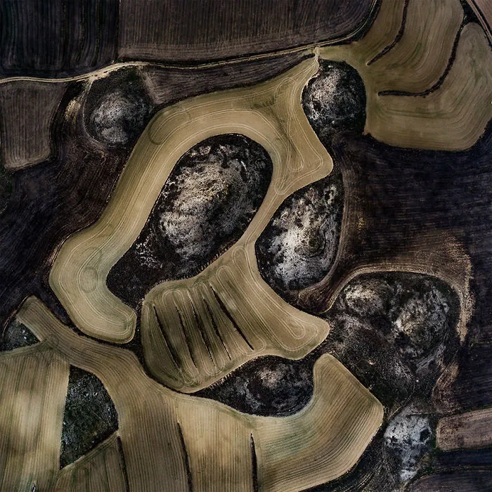
Amorphous forms of freshly hatched wheat plots and irregularly shaped soils covered with uncultivated dry vegetation wind around rocky hills.
Villamayor de Gállego, Zaragoza, Spain 12/29/2018
Size of territory: 426 m
9points
#22 Valdecelada De Cerca
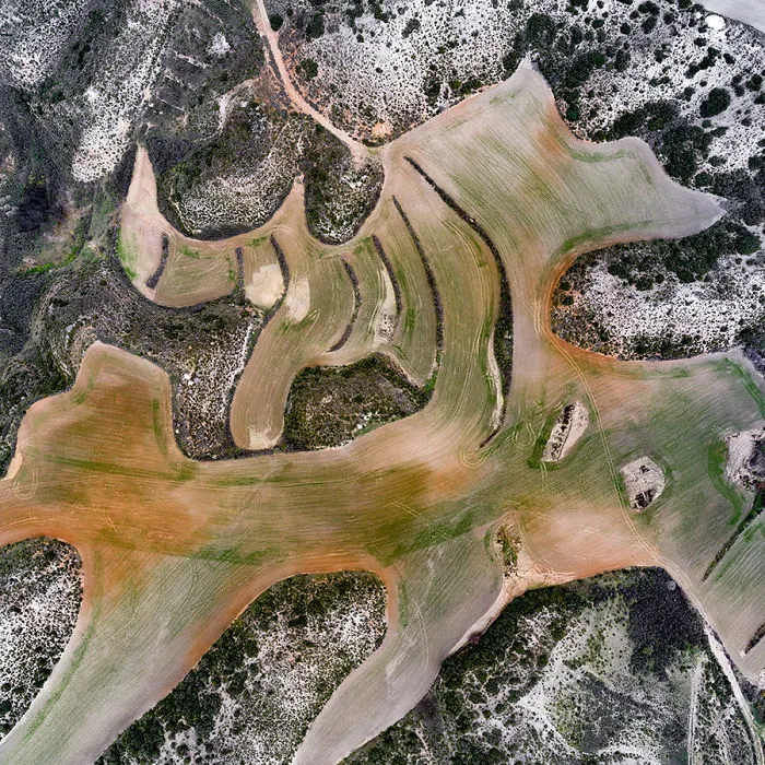
The cultivated landscape reveals different layers of soil during cultivation and mixes with the green color of freshly hatched wheat.
The catchment area of the Ebro, Peñalba, Huesca, Spain 12/29/2018
Size of territory: 406 m
9points
#23 Casar A La Guardia De Cerca
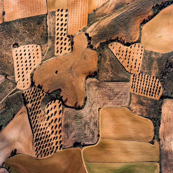
La Guardia, Toledo, Spain 12/31/2018
Size of territory: 408 m
9points
#24 Las Arroyadas De Cerca
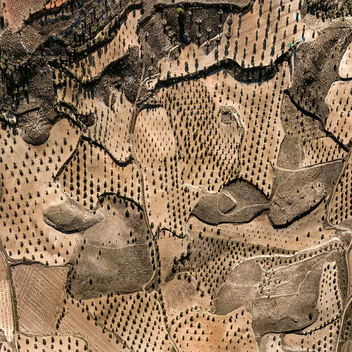
Size of territory: 592 m
9points
#25 Val De San Jorge
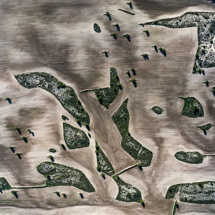
Trees on rocky hills form micro-islands in the newly cultivated agricultural area of Pina de Ebro near Bujaraloz.
Zaragoza, Spain 12/29/2018
Size of territory: 521 m
9points
#26 Vall De Mateo
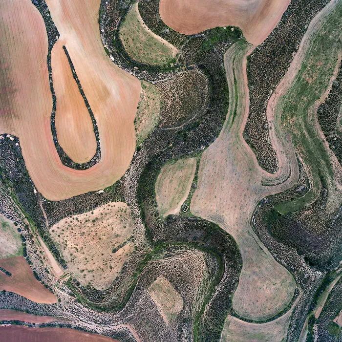
Size of territory: 626 m
9points
#27 Botorrita
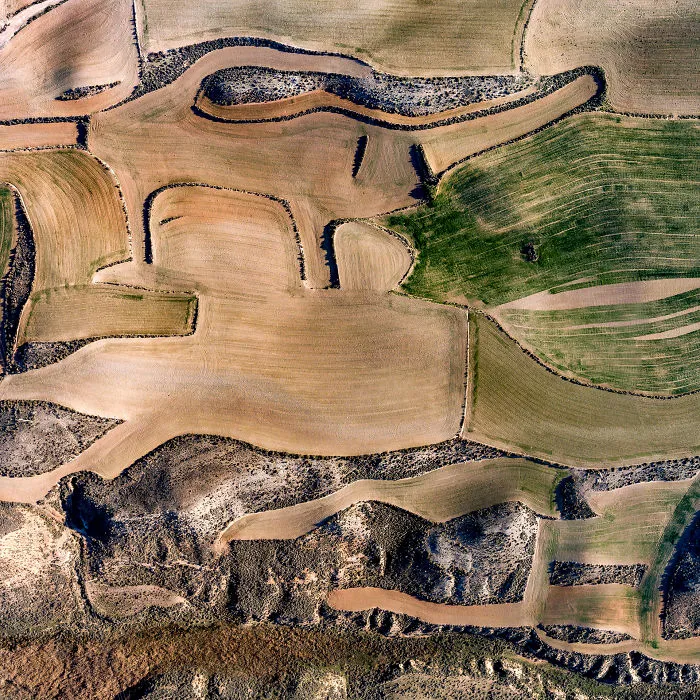
Stone walls around the former hills determine the form of Parcells where we encounter only wheat, which is harvested at the start of summer before the drought sets in.
Botorrita, Zaragoza, Spain 30/12/2018
Size of territory: 428 m
8points
#28 Val De Sonda
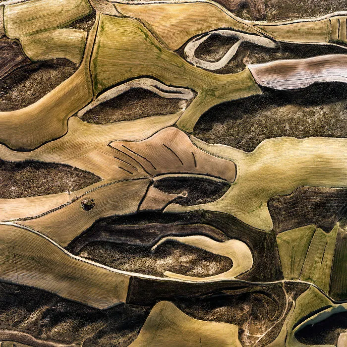
Small hills covered with dark, withered grass was surrounded with crop fields where fresh wheat was just hatched. The tiny lines are stone walls to keep soil and water on the lands.
Villamayor de Gállego. Zaragoza, Spain 30/12/2018
Size of territory: 680 m
8points
#29 Peñalba Brumoso
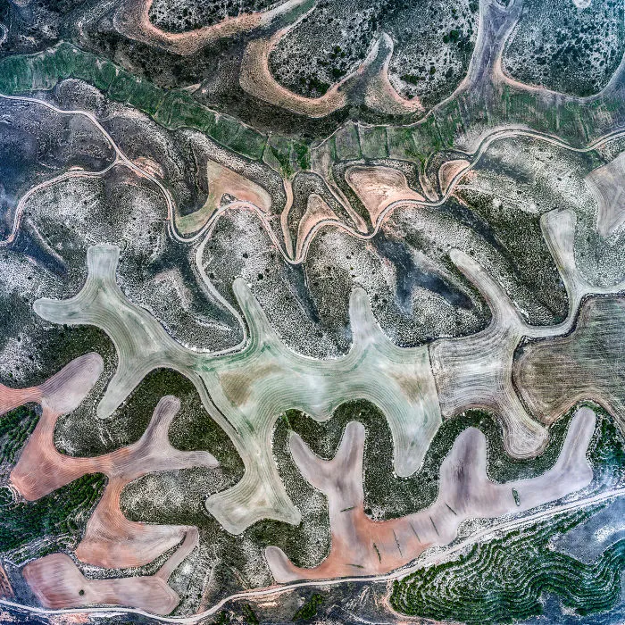
Cultivated landscapes reveal layers of the soil of different colors, deposited thousands of years ago by rivers in the Ebro catchment area, and reveal the amorphous features of the terrain, photographed in foggy conditions.
Peñalba, Huesca, Spain 12/29/2018
Size of territory: 803m
8points
#30 El Presado
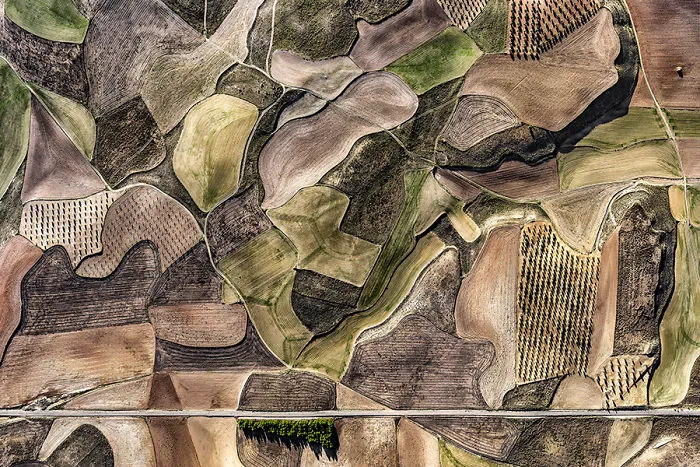
La Guardia, Spain
Size of territory: 1060 m
8points
#31 Vall De Mateo
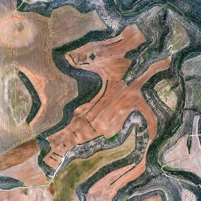
Size of territory: 835 m
8points
#32 Vall De Mateo
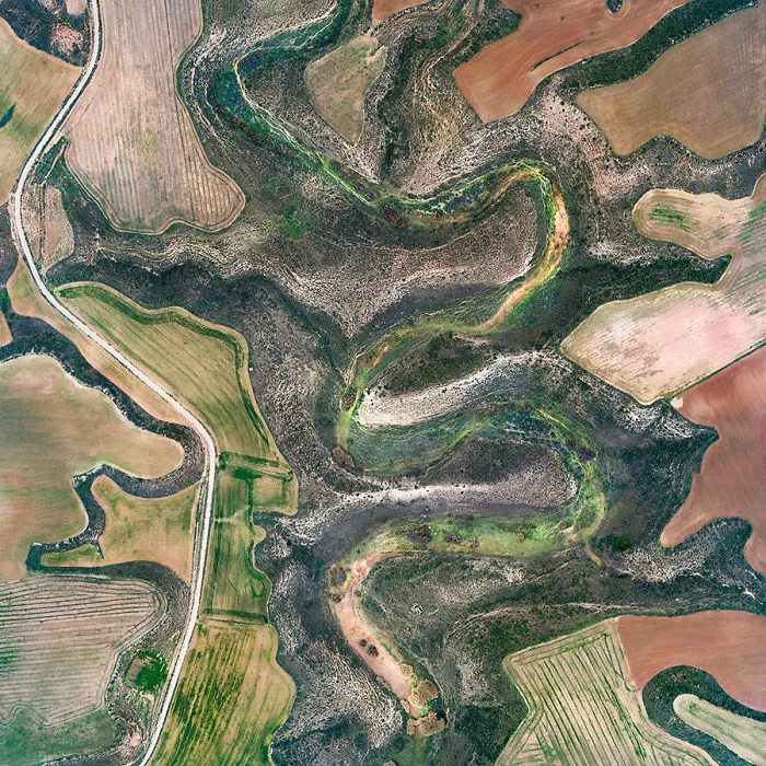
Size of territory: 947 m
8points
#33 La Muela
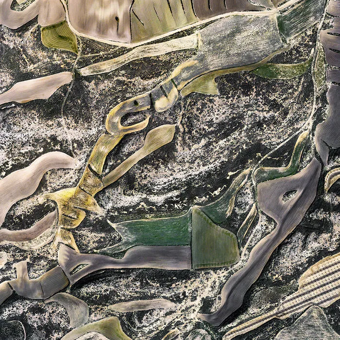
La Muela, Zaragoza, Spain 12/30/2018
Size of territory: 714 m
7points
#34 Val De Carro
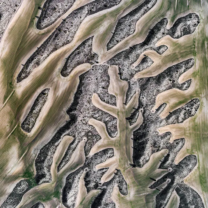
Pina de Ebro, near Bujaraloz. Zaragoza, Spain 12/29/2018
Size of territory: 775 m
7points
#35 Curvas Del Caracol
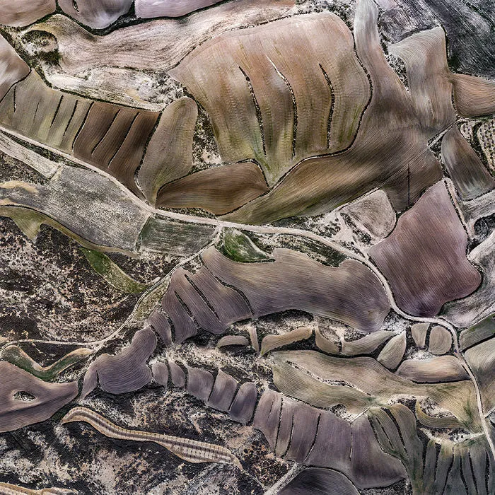
La Muela, Zaragoza, Spain 12/30/2018
Size of territory: 702 m
6points
#36 Las Arroyadas
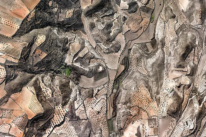
Colmenar de Oreja, Spain
Size of territory: 1660 m
6points
#37 Vall De Mateo
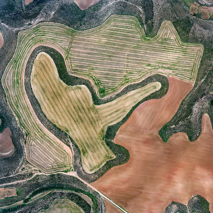
Along the dried-up river, different levels of cultivated soil reveal millennial sand-pebble deposits in different colors.
Fraga, Huesca, Spain 12/28/2018
Size of territory: 752 m
6points
#38 Calle Collados
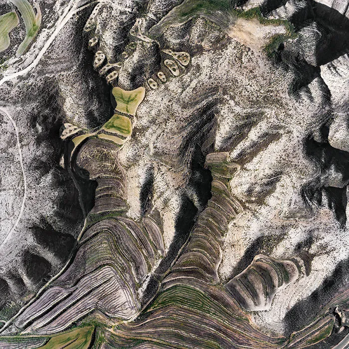
Jualin, Zaragoza, Spain 12/30/2018
Size of territory: 640 m
6points
#39 El Meridiano
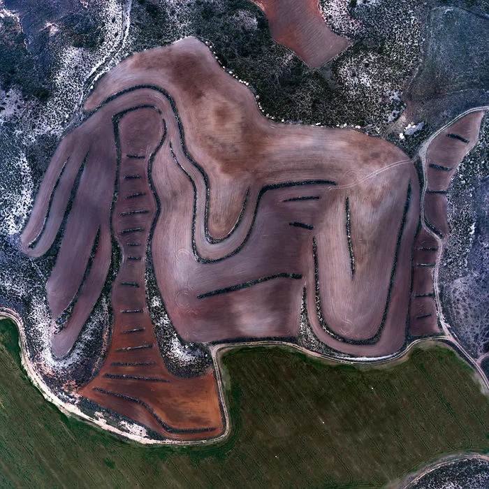
Near Candasnos, Huesca, Spain 12/28/2018
Size of territory: 413 m
6points
